The week has mainly been filled with family activities which are always fantastic. My granddaughter was in town so that got priority when we could do something. Today was a day off from Grandpa so I figured I’d get out hiking. Argentine Peak and Mount Wilcox had been on my list of peaks for a while. Now was my chance to check them off!
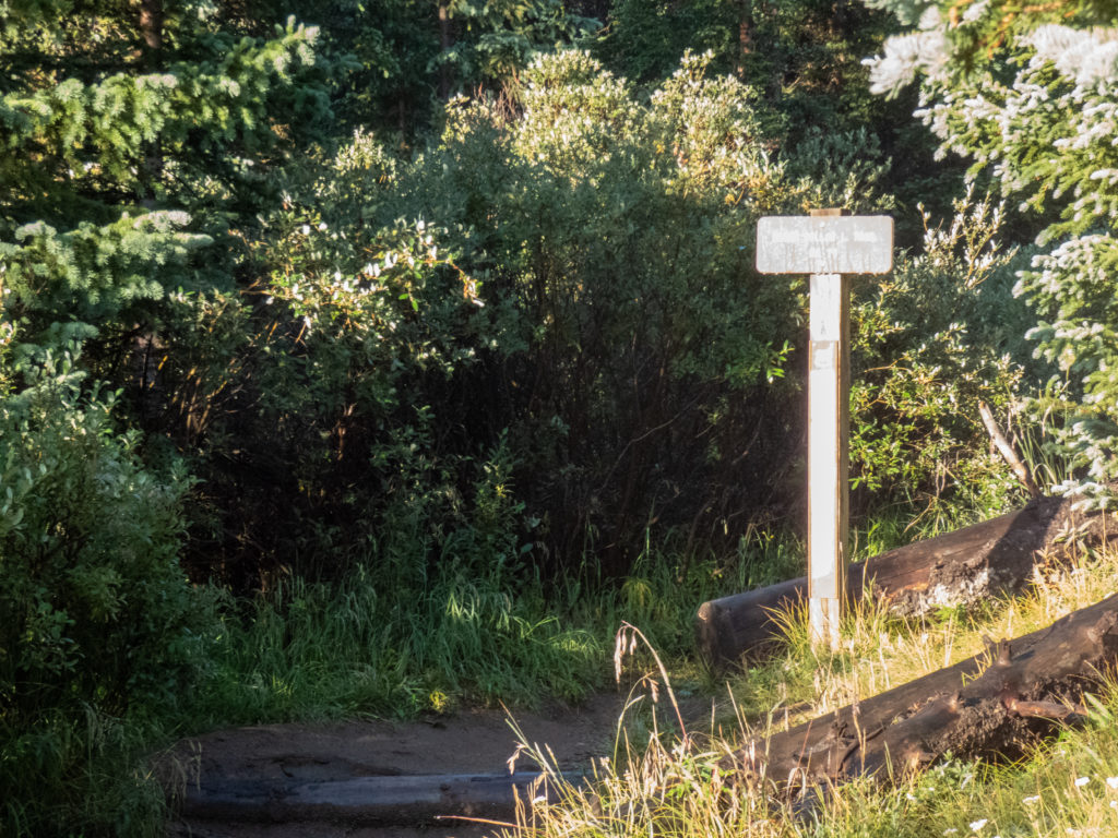
Beautiful morning at the Trailhead
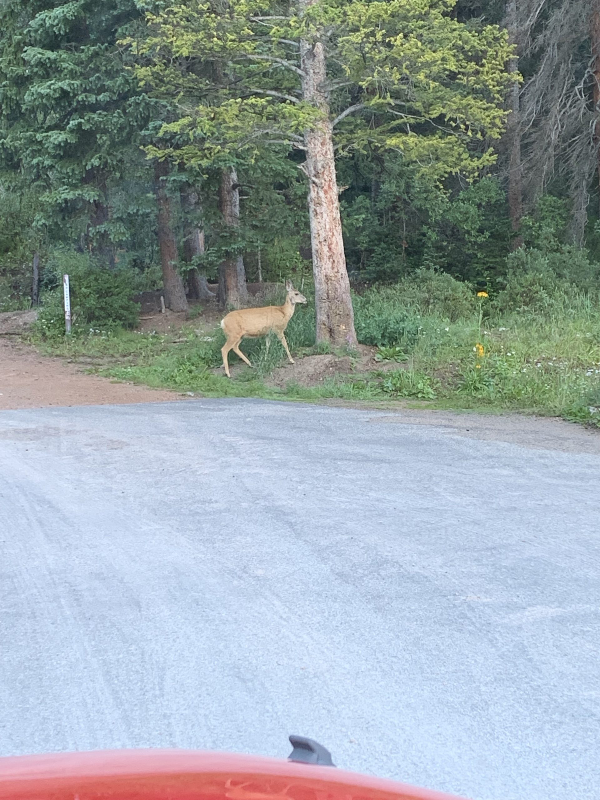
The trip up to Guanella Pass was very easy. I left the house about 5:40AM so traffic was light. The temps were in the 60’s when I left Littleton meaning it’d be nice and cool for the hike. Heading up Guanella Pass road was uneventful. When I turned onto the road to the trailhead, there was a deer staring back at me. I took a quick shot as it headed into the woods. No one else was at the trailhead when I arrived around 7:00.
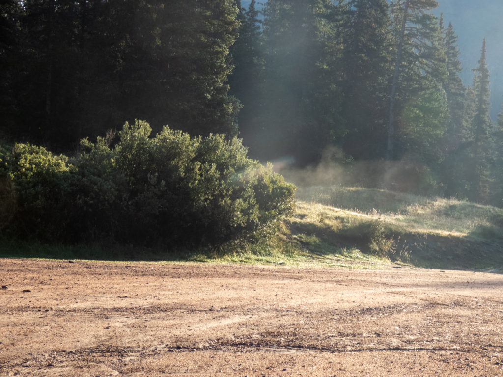
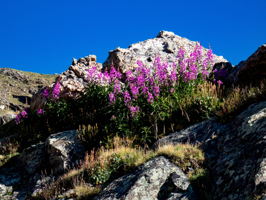
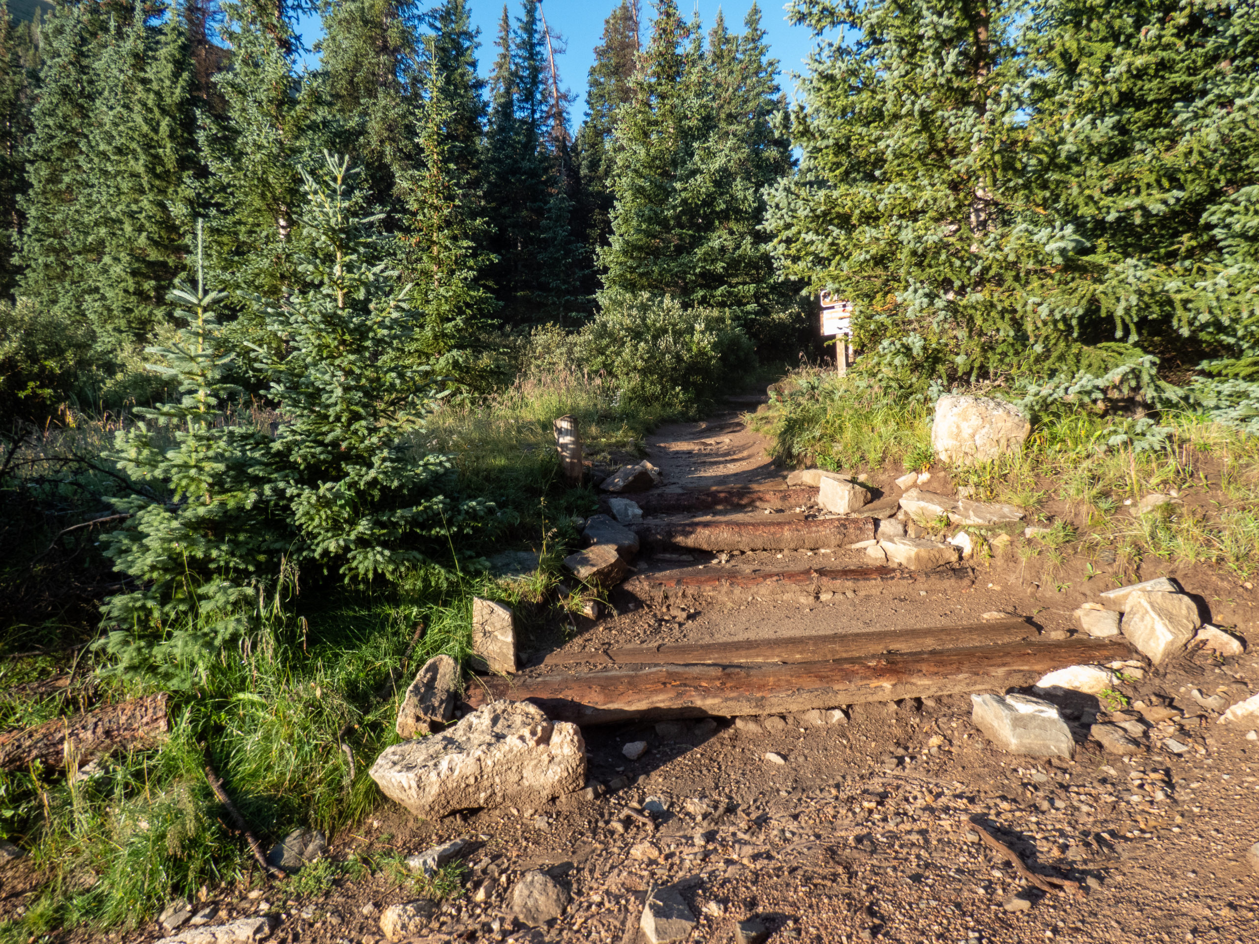
The sun was starting to hit the wet bushes causing steam to rise. It was an experience, the picture doesn’t do it justice. The temp was 39, perfect! By the time I put on my boots, pack and headed out, it was 7:10.

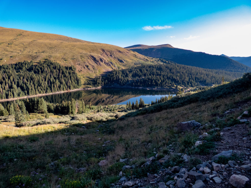
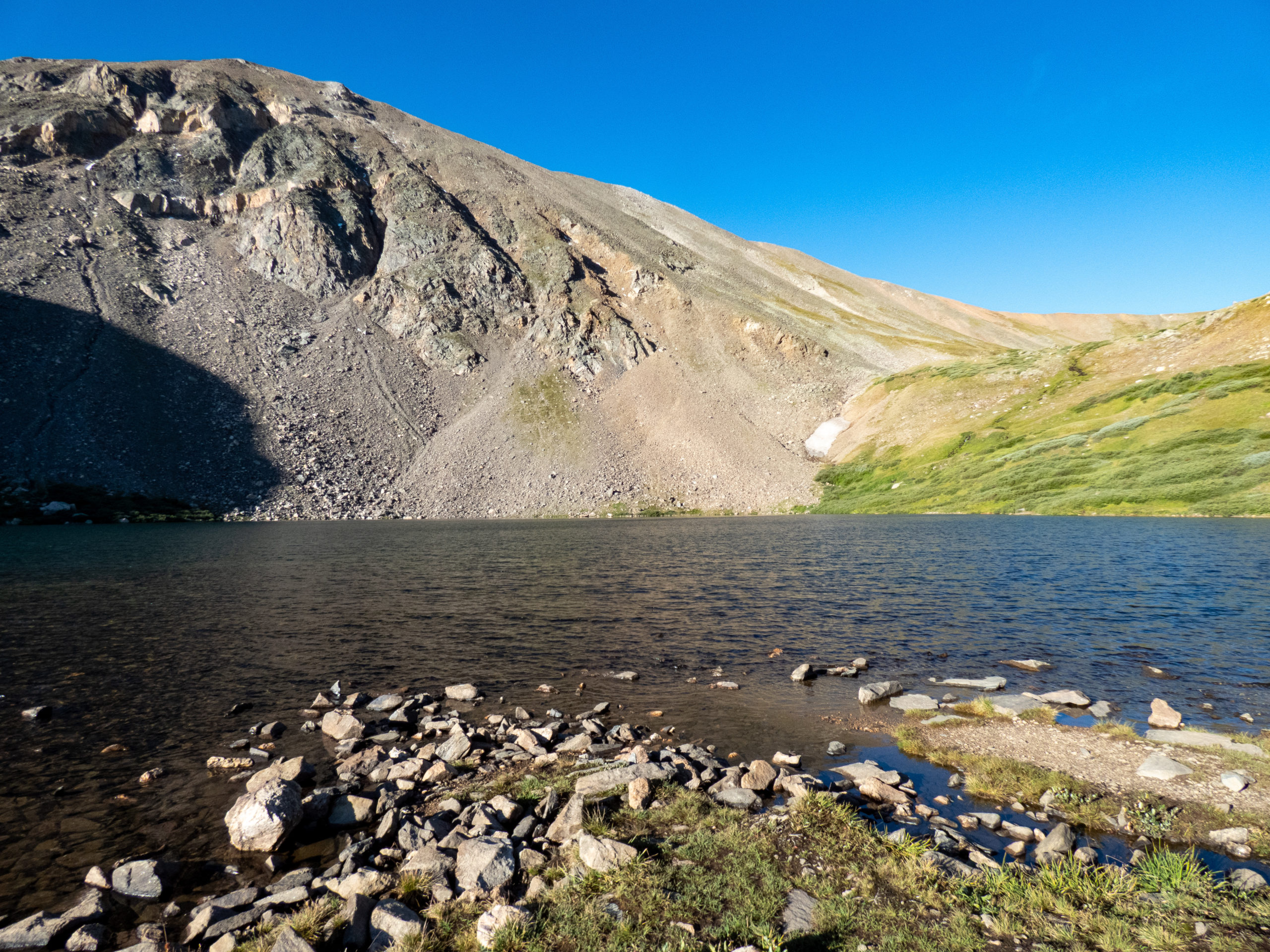
First, the lakes
The approach I was using for Argentine Peak and Mount Wilcox was to follow the trail towards Silver Dollar Lake and Murry Reservoir. The trail offers really good views. The views of Naylor Lake start around .5 miles. This morning, it was very still and provided great reflections. Unfortunately I wasn’t high enough to get a great mountain profile caught in the reflection. Still, the moment was something to treasure.
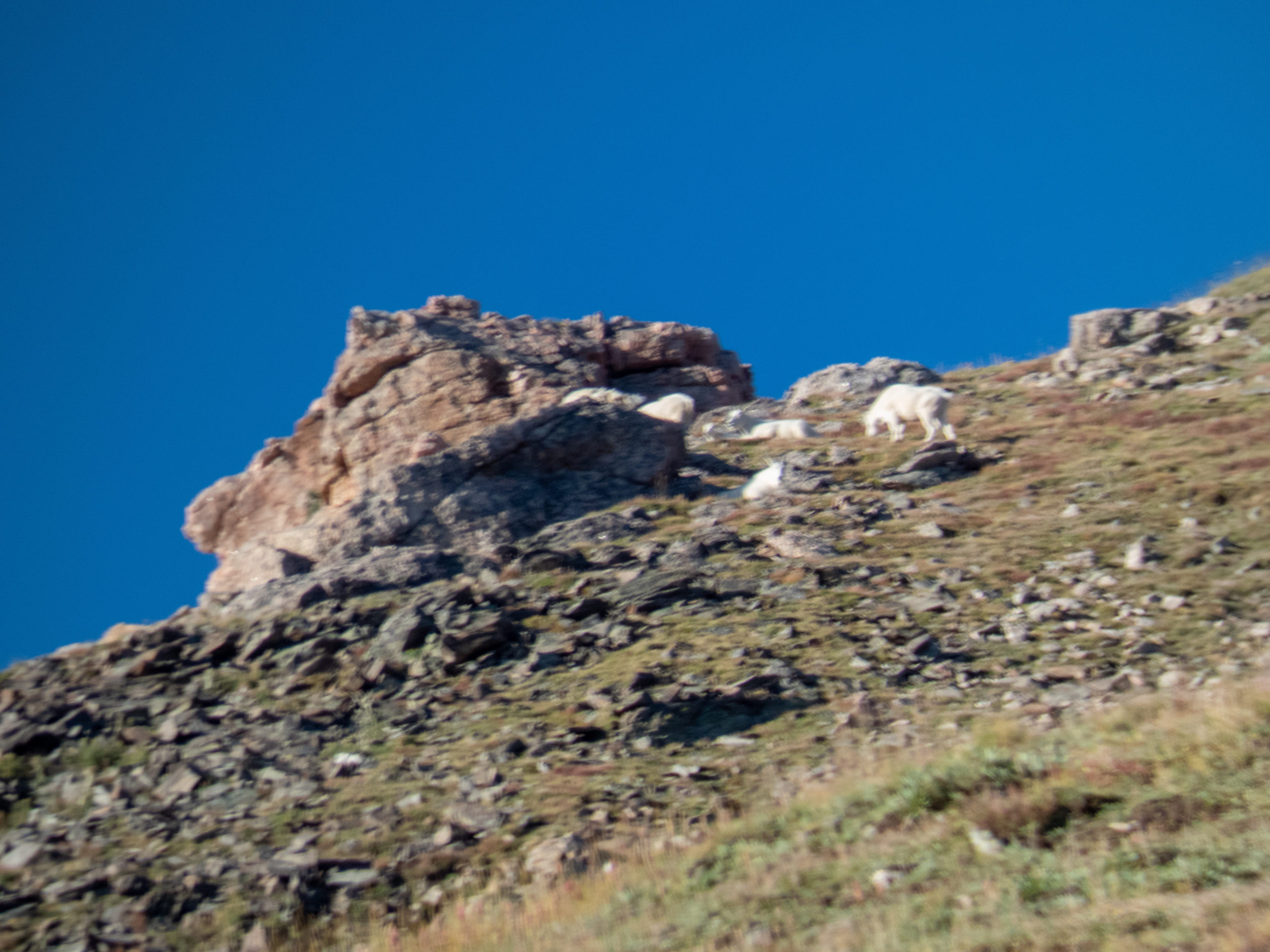
As I happened to glance towards the ridge to the south of the trail, I saw a mountain goat up high. It was at the limit for me to get a zoomed in picture, and of course, it turned out blurry. Nothing like the mountain goat encounter I had on Red Peak, although it’s always great to see them.
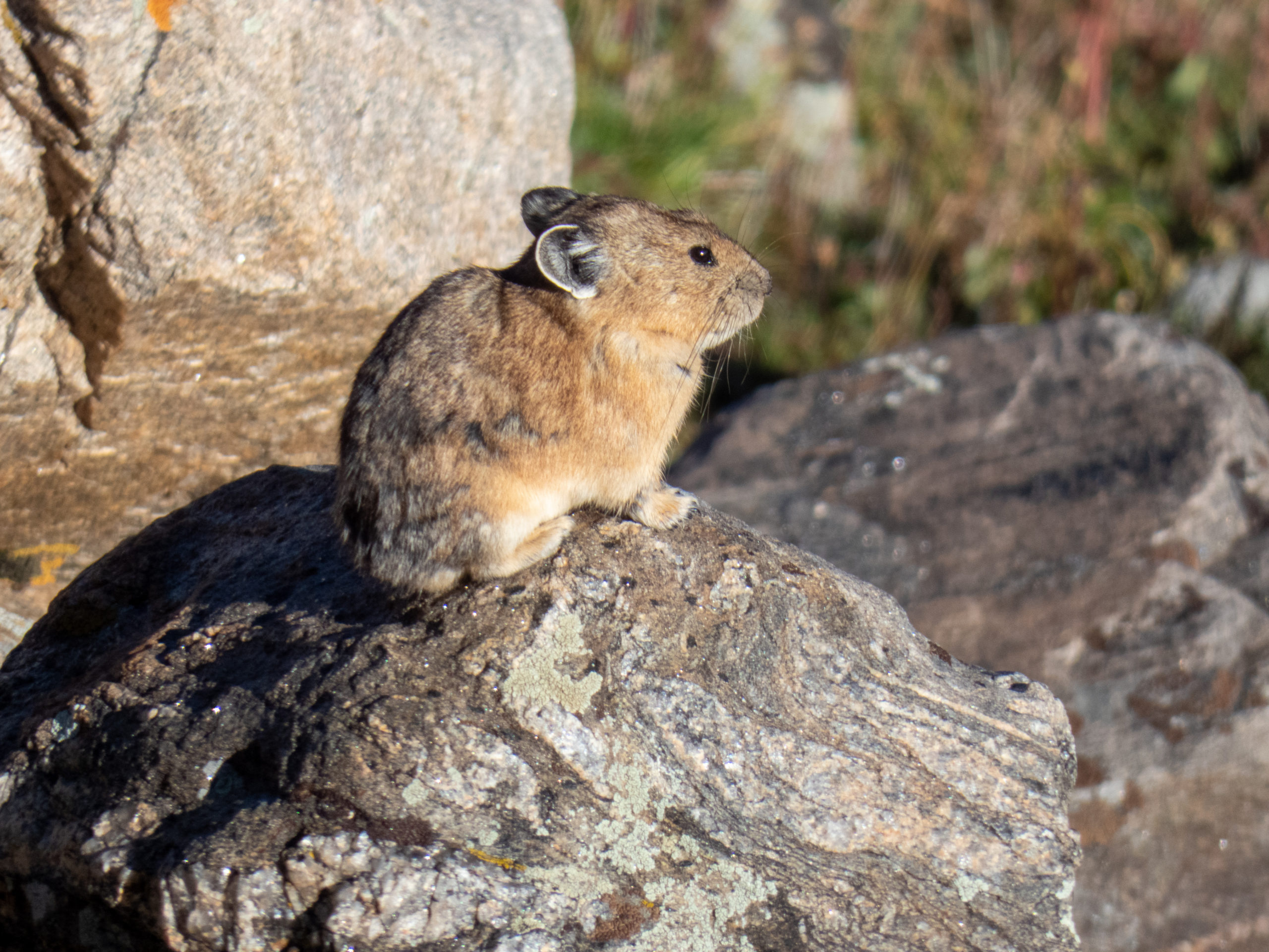
About halfway between Naylor and Silver Dollar lakes, there is a boulder field where a lot of pika live. This morning one was chastising me for invading their space. To get even, I took a picture of him.


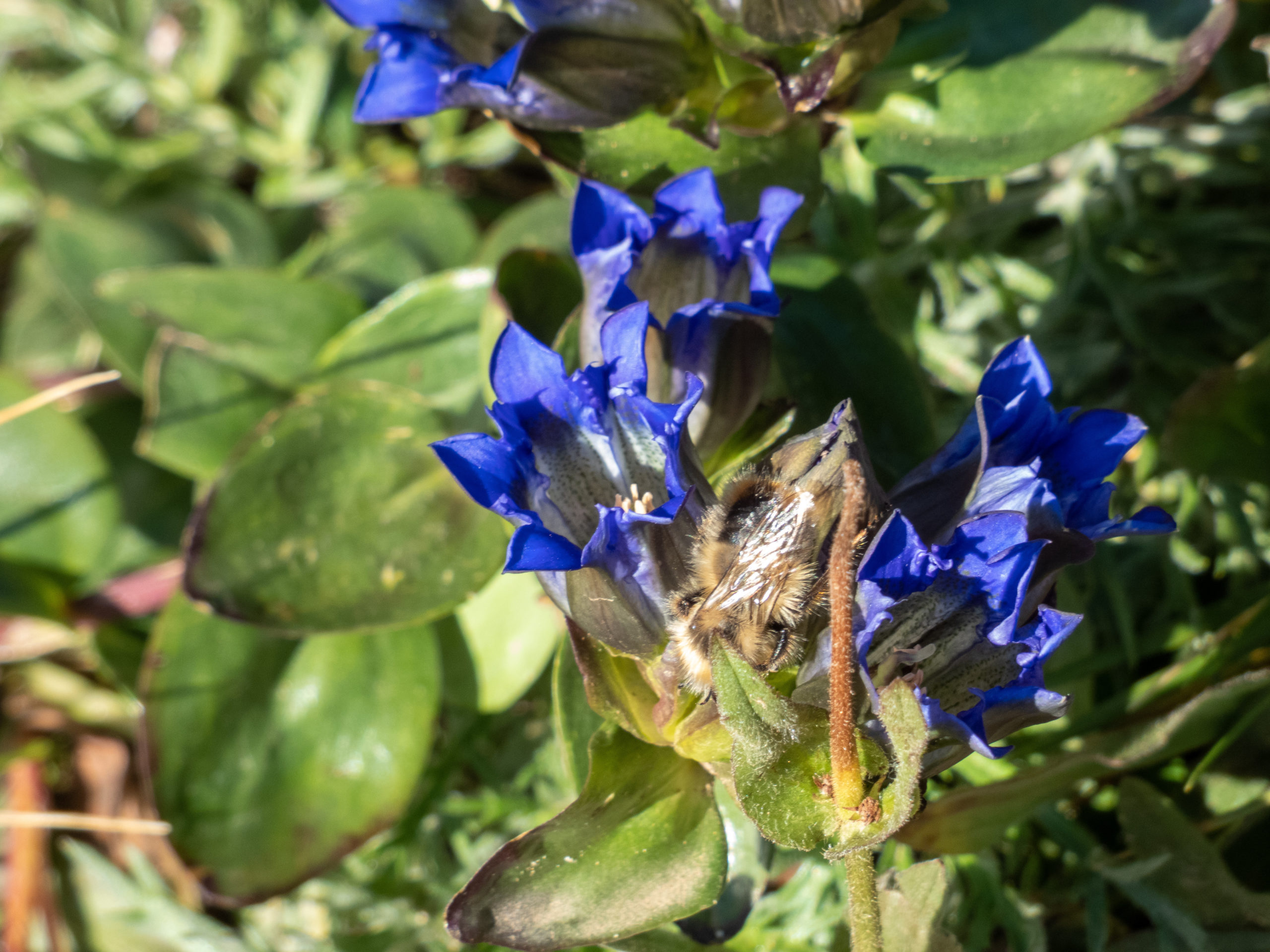
The trail between Naylor Lake and Silver Dollar Lake has a mild incline and is even flat in some places. It’s a short .9 miles from the Naylor overlook to Silver Dollar. This lake wasn’t as calm. I took a picture with the north face of Square Top Mountain in the background. There were still some flowers out and I captured a bee busy gathering pollen.


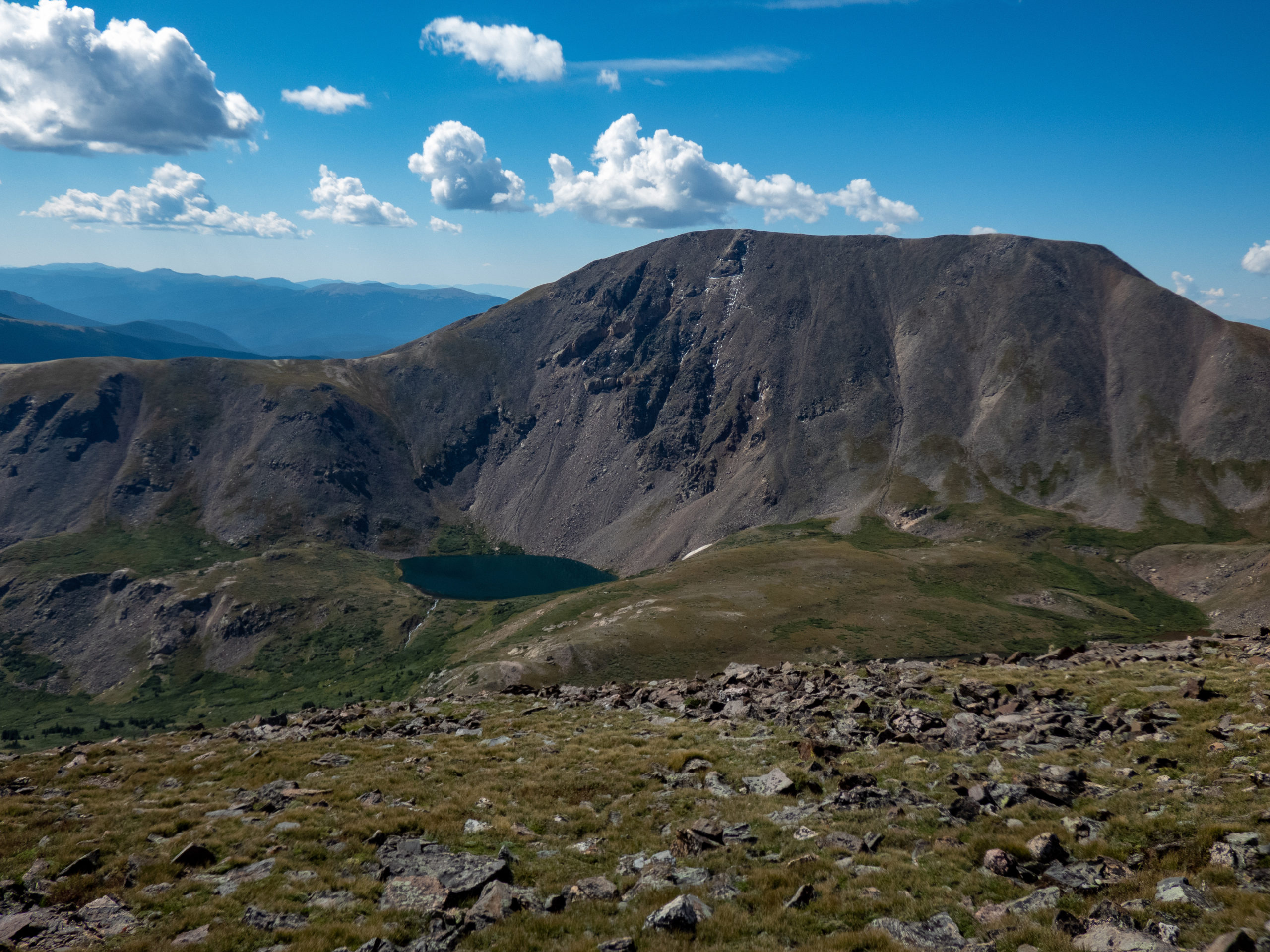
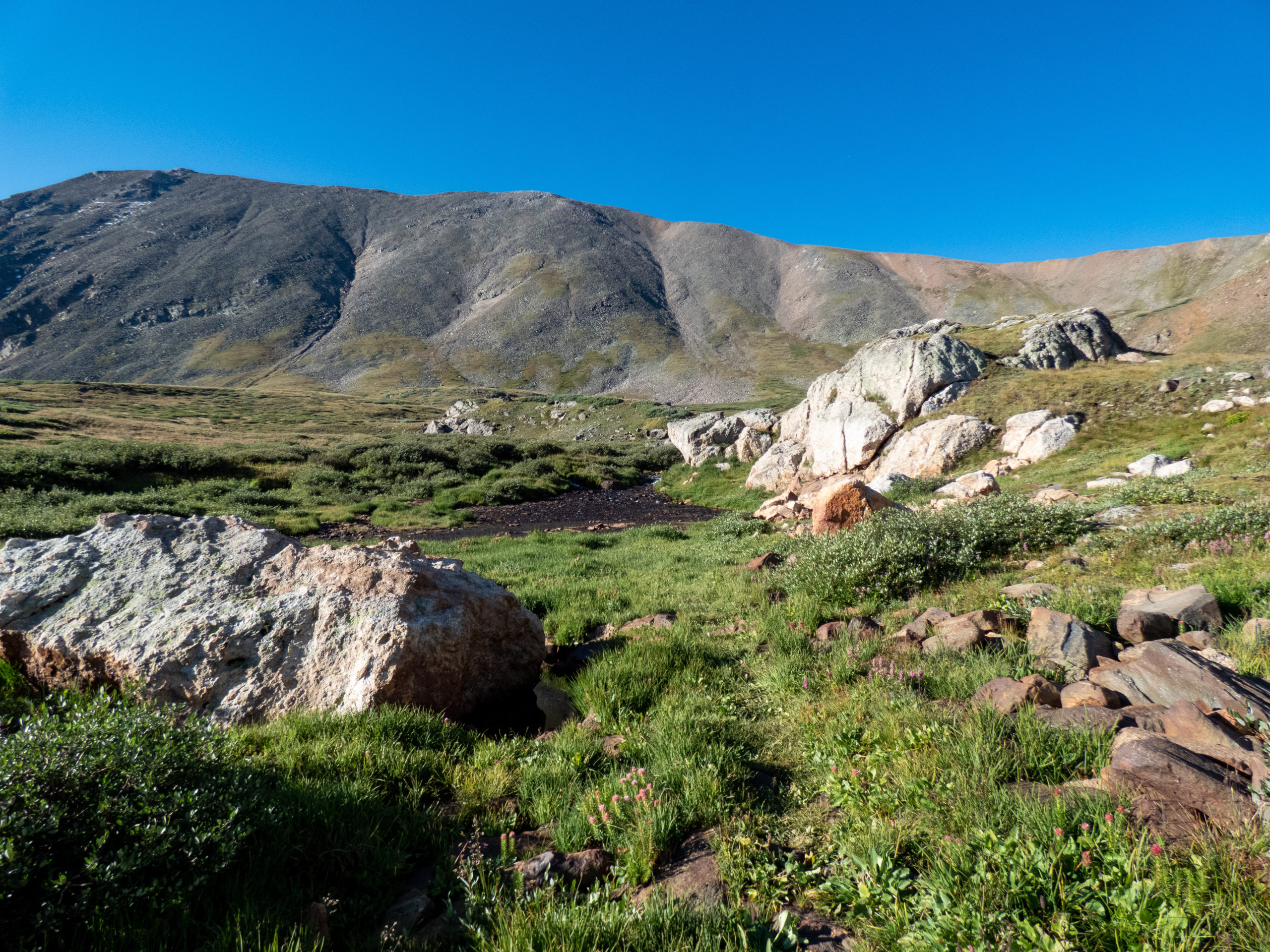
Once past Silver Dollar Lake, the trail heads up a steeper incline to Murry Reservoir. Normally when hiking with family and friends, Murry Reservoir would be our destination. Today, I stayed south of the lake and headed west towards the inclines up to Argentine Peak. I looked south and took a pic of Square Top Mountain with a nice stream as the foreground. There is no trail from this point so I looked up, picked a reasonable path, and got to it.
Leaving the trail
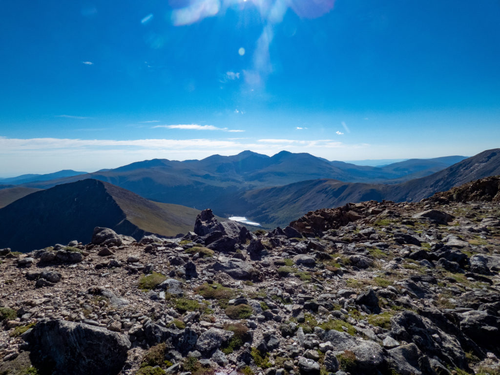
As you can see from the GPX track, the incline picks up a bit at this point. Once in a while I’d see some pretty flowers giving me a good reason to stop, catch my breath, and take a picture. Other times I’d just stop to catch my breath so I wouldn’t pass out. I saw another mountain goat but wasn’t fast enough to get a pic. The trickiest part of this section was to avoid the willows which wasn’t too hard. Near the ridgeline at 12,800′ or so, the rocks were pretty loose. I stayed to the right near a boulder line to provide some handholds as I navigated up. The hiking poles were very useful this entire climb. While you’re doing this, don’t forget to look back. The views of Murry Reservoir and Naylor Lake in the distance are quite beautiful. The sun was in the background so I didn’t get a picture. You’ll have to take my word for it.

Once I cleared the ridgeline, the hike wasn’t nearly as steep. I headed towards the power line (yes, there is a power line up here, no complaints though, I use electricity) and crossed a small stream near the utility pole. The peak is visible so I headed directly up the slope and made reasonable time to the summit.
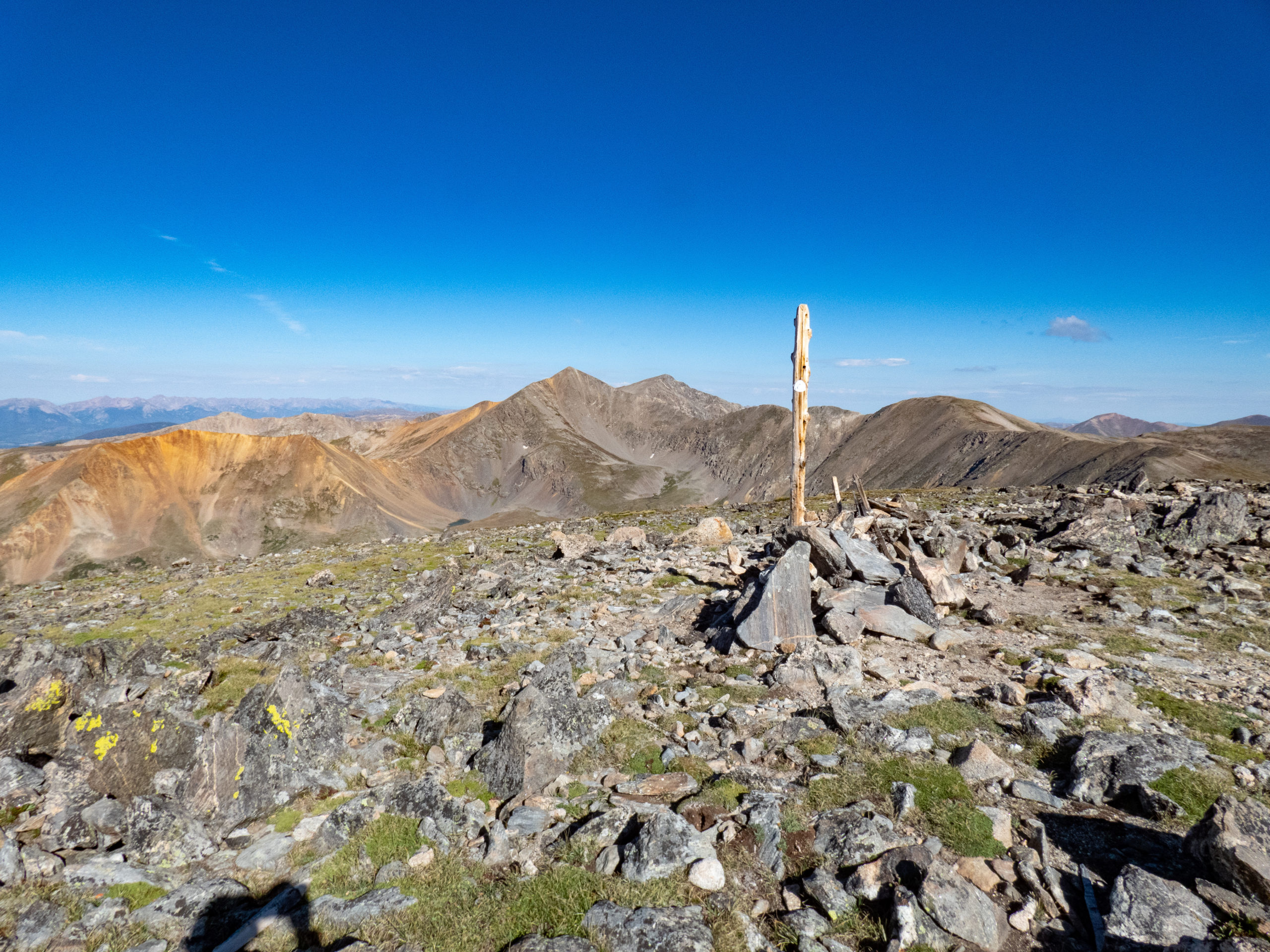
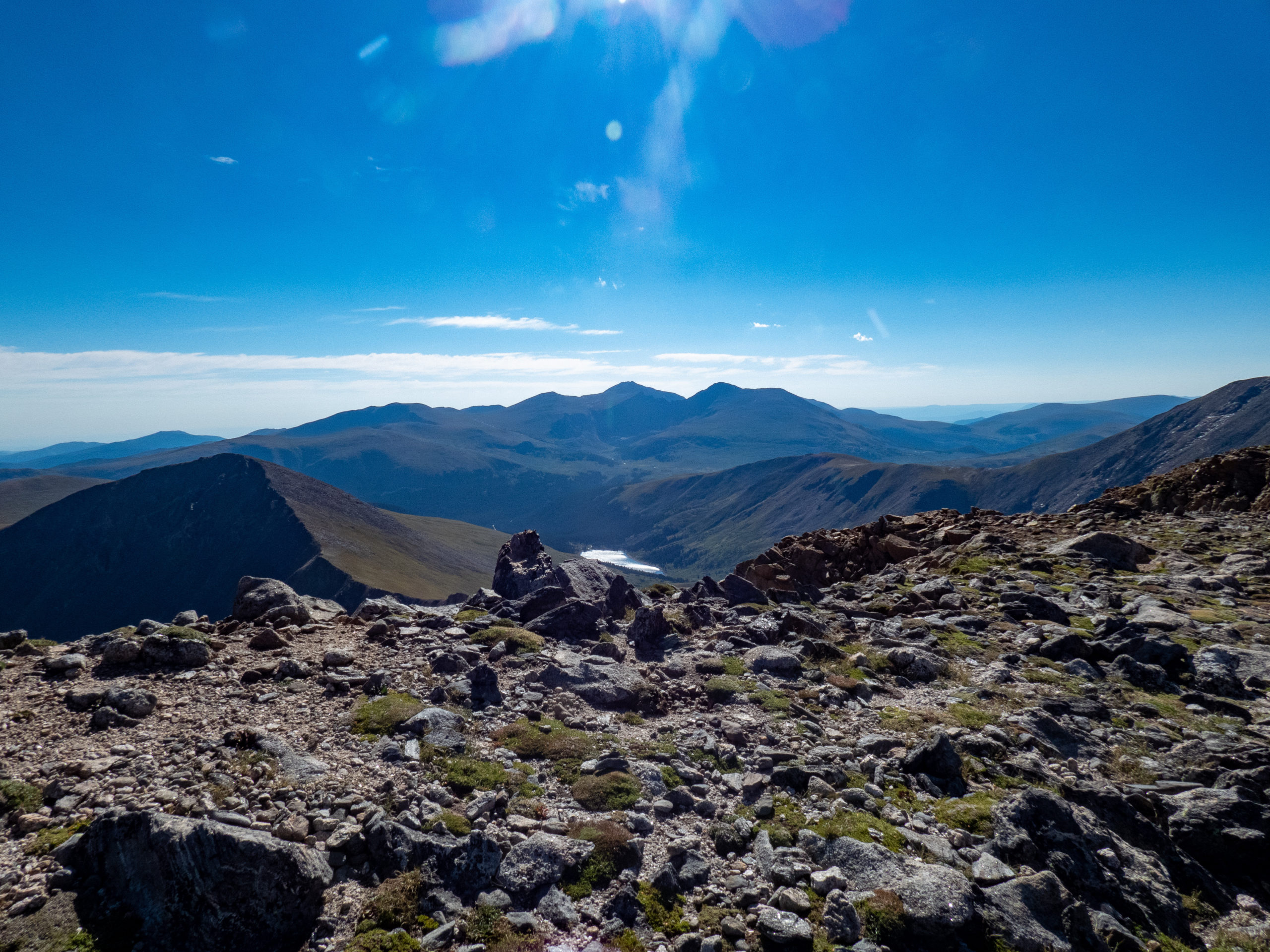
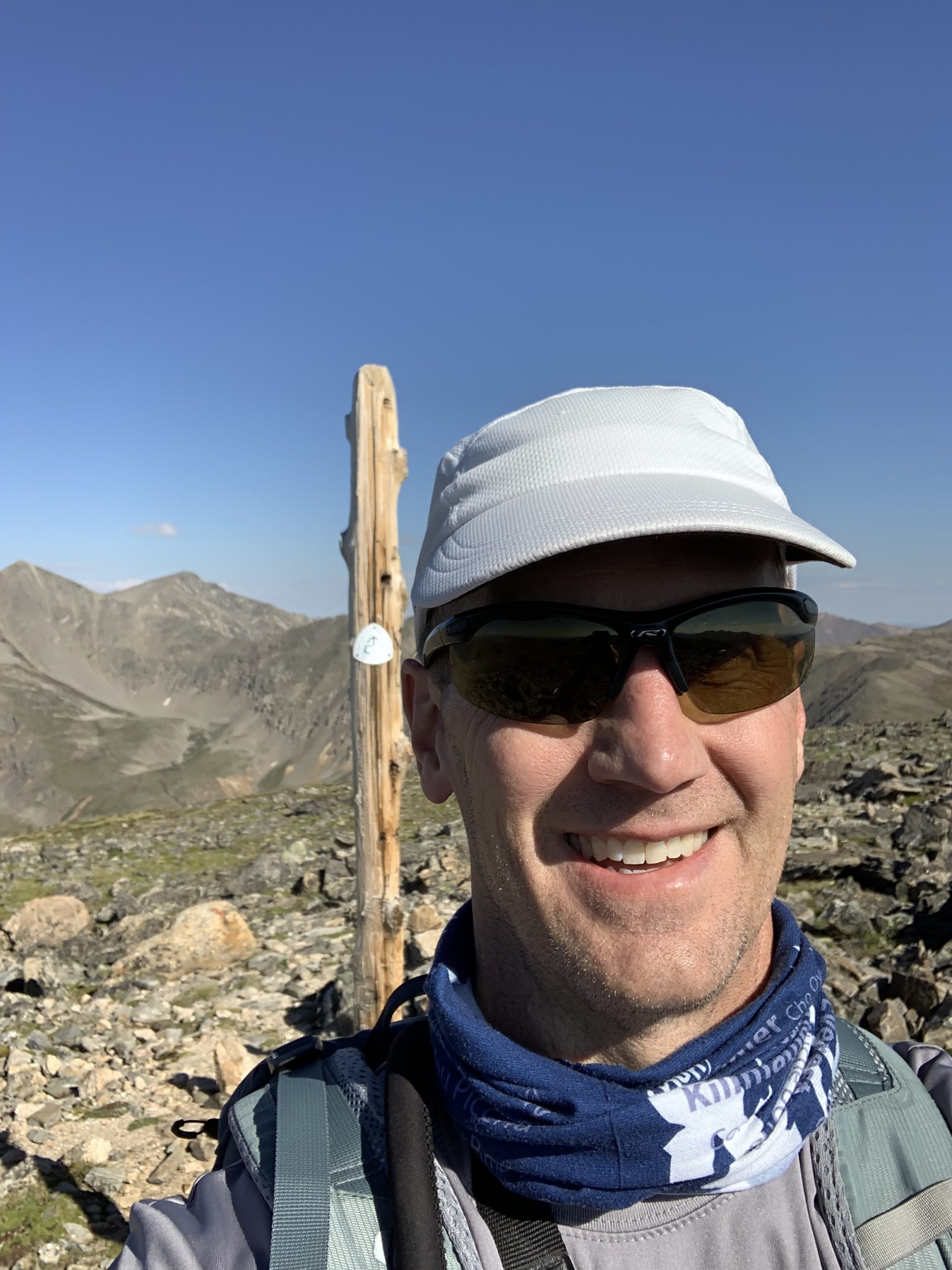
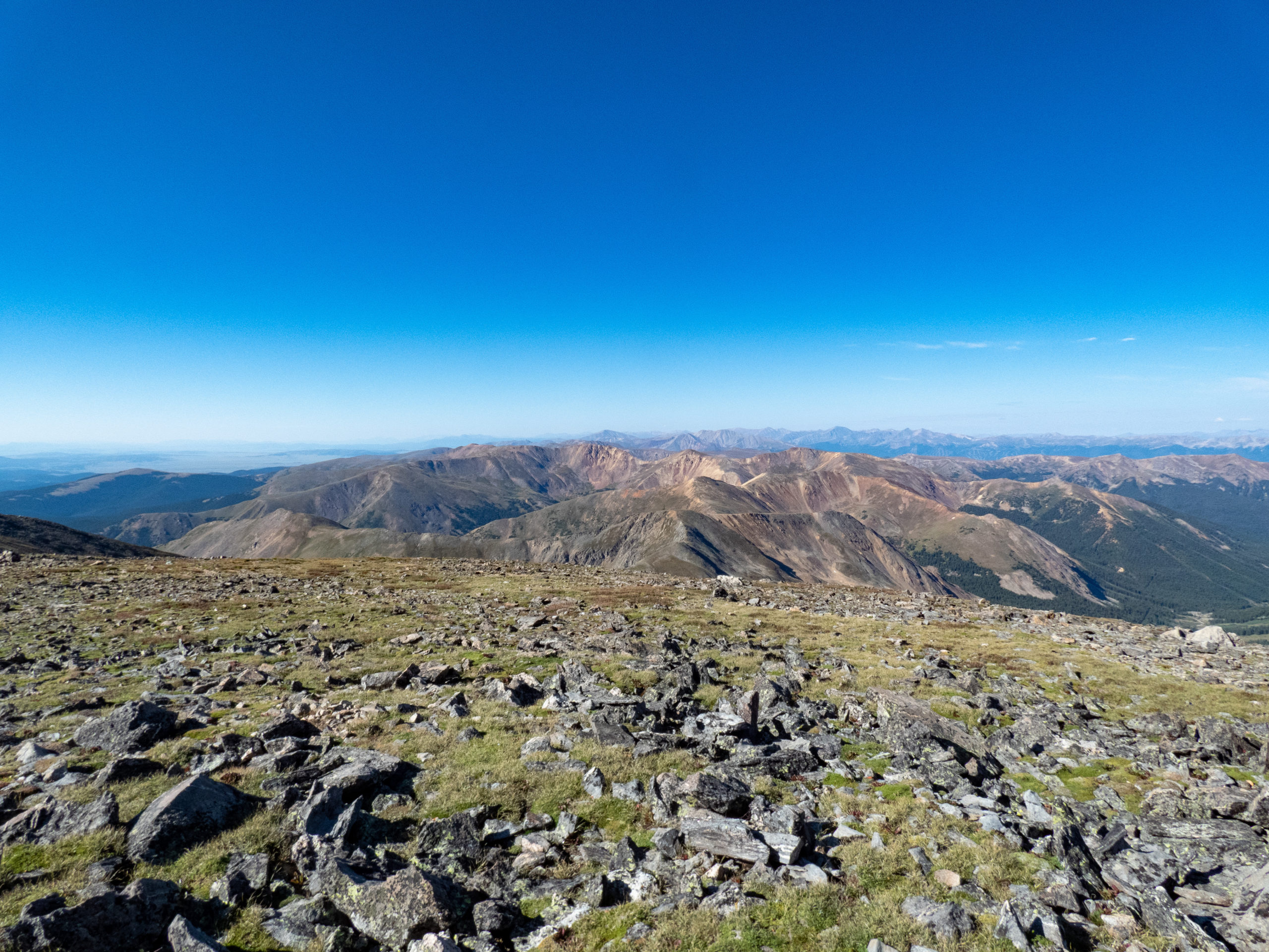
Argentine Peak Summit
I believe the official Continental Divide Trail goes to the west of this peak, although the peak itself is on the Continental Divide. I’m guessing that because I looked it up on GAIA GPS and there was a pole with the Continental Divide symbol on it…I’m smart that way ?. A bit of trivia, the highest pass on the Continental Divide Trail is Argentine Pass, just north of Argentine Peak. OK, my job here is done.
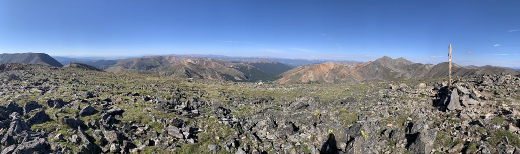
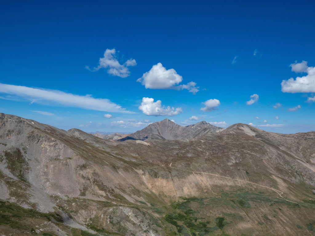
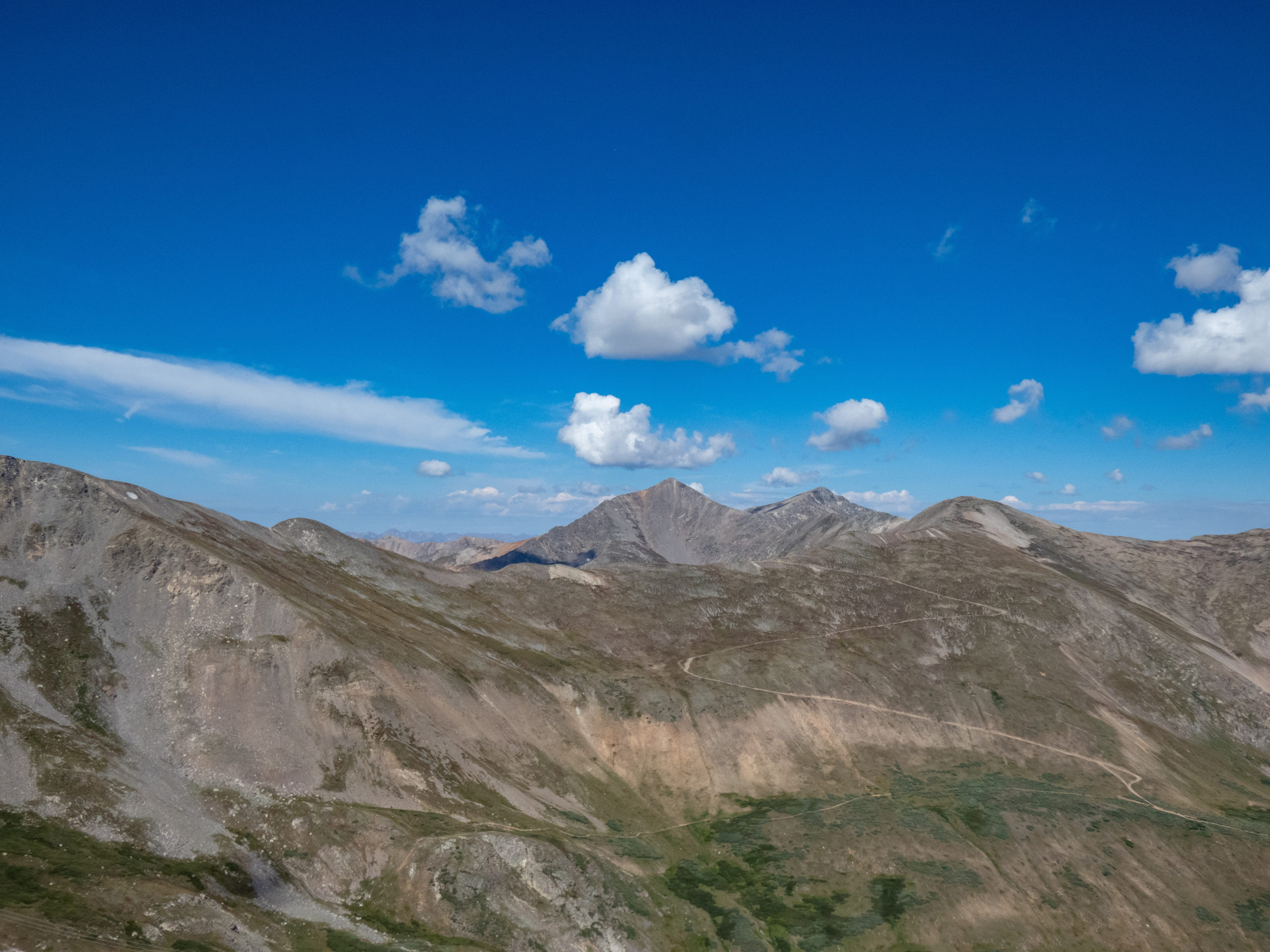
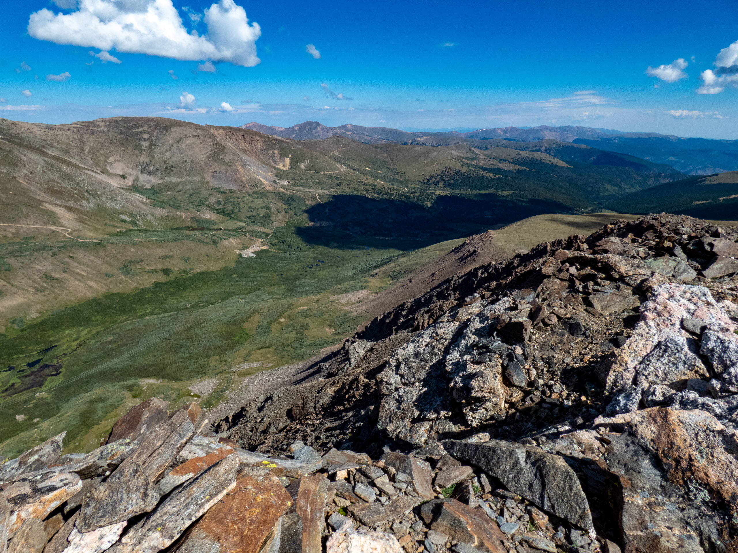
Now back to the hike…the views from Argentine Peak are incredible. To the northwest, Grays and Torreys dominate the foreground with the Tenmile Range visible in the distance south of those two peaks. Looking more southwest, there are 12ers and 13ers like Whale Peak in the foreground with more of the Tenmile Range in the background. Looking east, Mt. Bierstadt and Mt. Evans dominate the horizon. The sun was out, the wind was quiet, and wonderful views filled 360°, what more can you ask for?
I went ahead and signed the register, had a snack, and headed out after soaking it all up for a while.


Heading over to Mount Wilcox
While I was up here, I figured I should go ahead and bag Mount Wilcox. The hike over to Mount Wilcox isn’t too bad, basically you head down into the saddle between Argentine Peak and Mount Wilcox, and then back up to the summit. There is a utility pole right at the saddle point, so that’s where I headed.
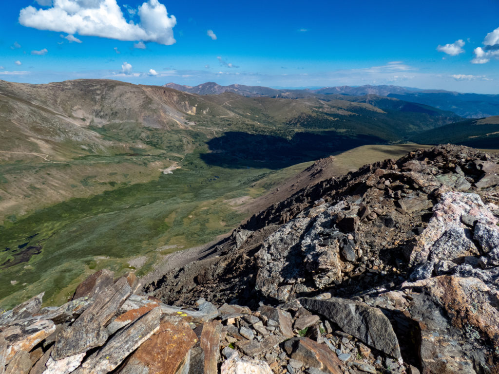
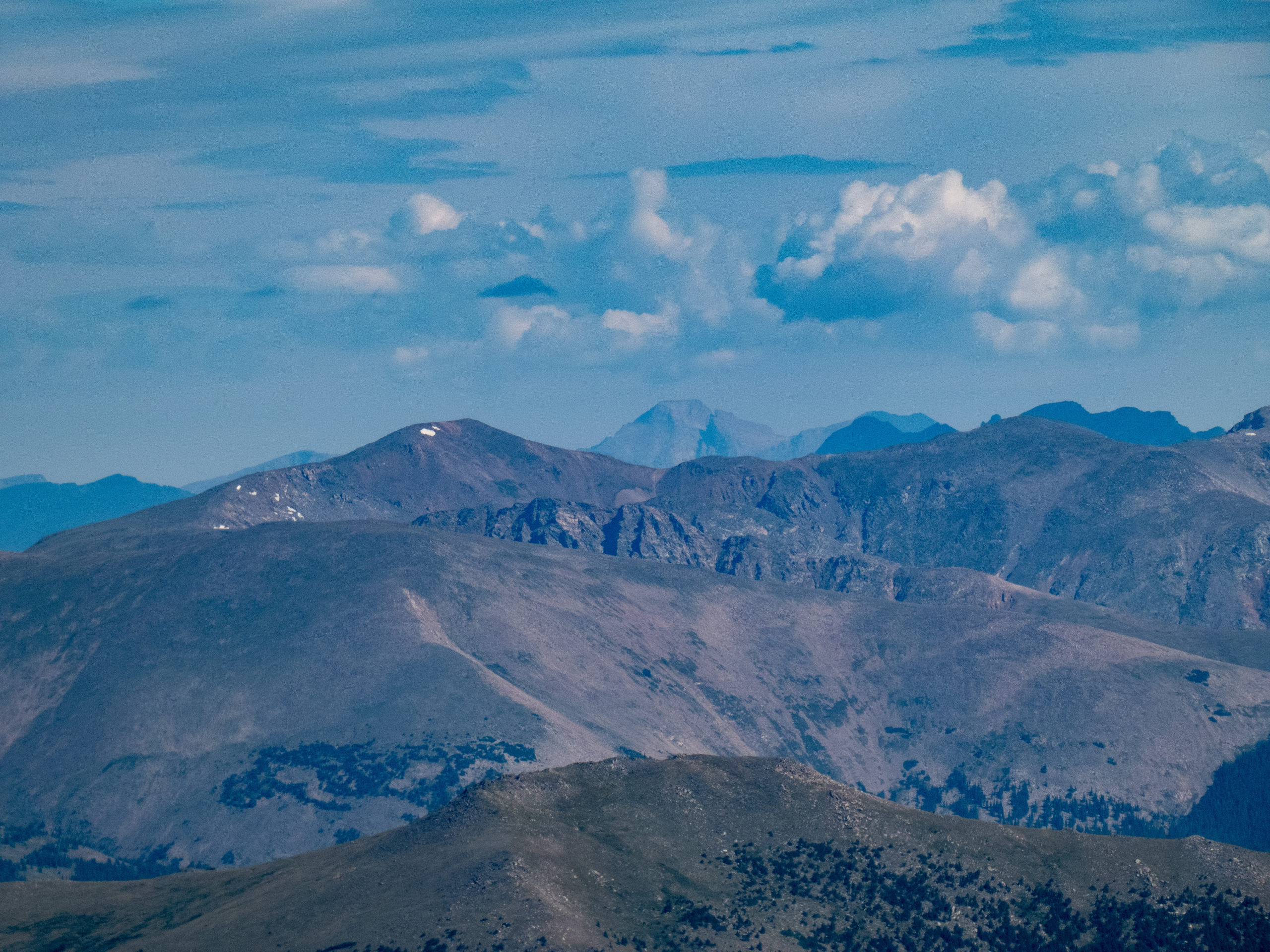
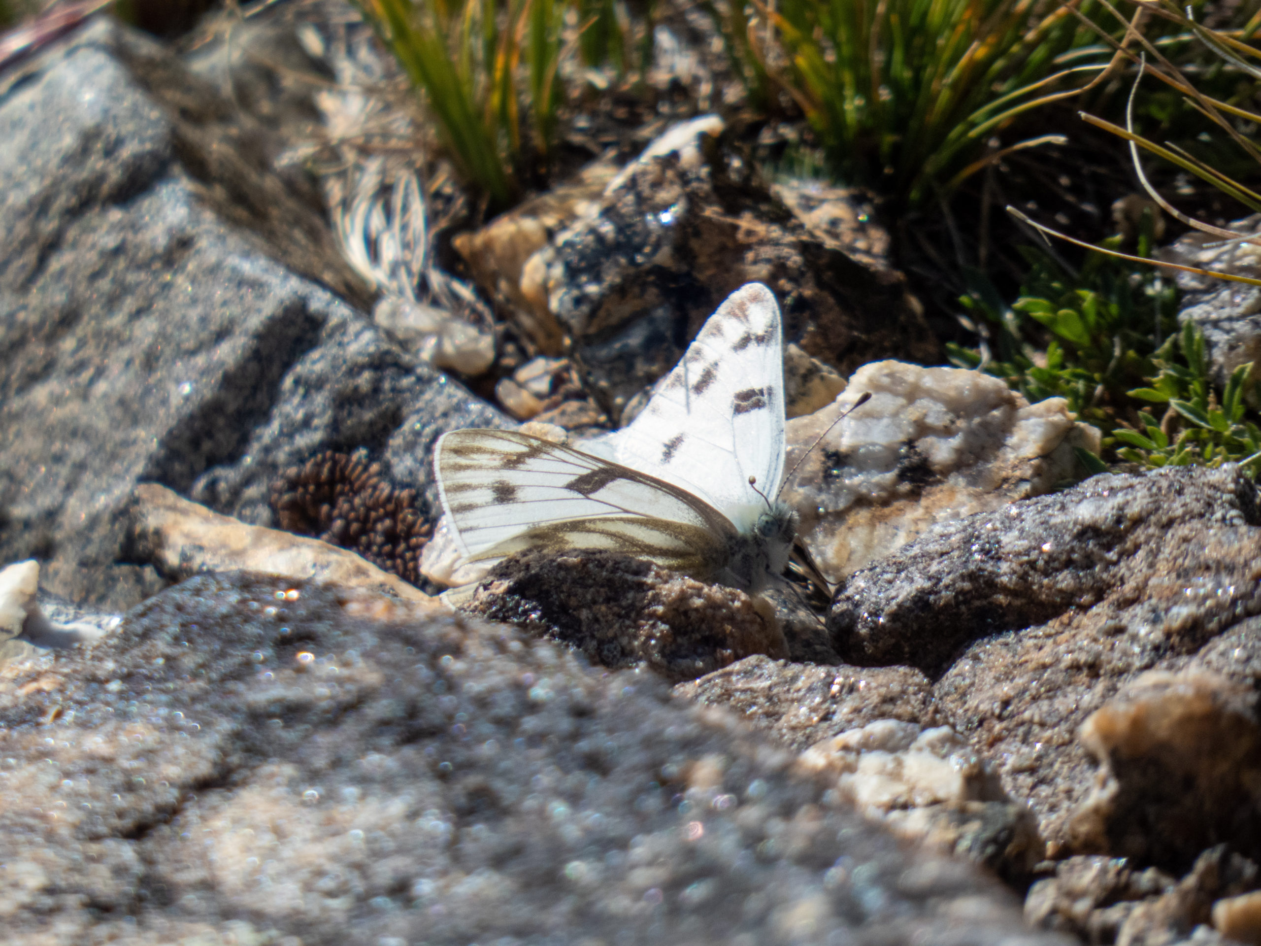
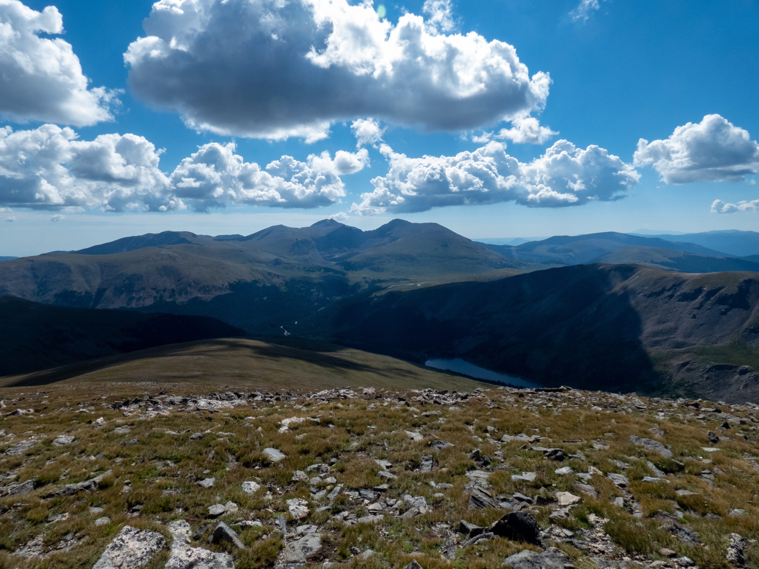
The trek wasn’t especially steep. It’s mainly a boulder field near the top of Mount Wilcox. I scrambled up the rocks and past the 2-3 false summits and gained the real summit. Mount Wilcox also offers great views, especially of the meadows to the north. I took many of the same photos, except this time Grays and Torreys had part of Argentine Peak to the left. There was also a good view of Square Top Mountain. Way off in the distance, I saw what I believed to be Longs Peak. While hanging out, a pretty butterfly stopped by so of course I got a picture of it.


Return from Argentine Peak and Mount Wilcox
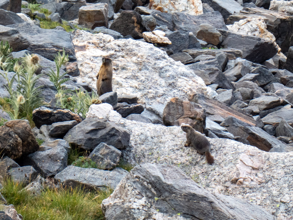
The clouds were starting to move in so I decided to head down. I took a more direct path to Murry Reservoir. The first part of the descent was through a boulder field so not the easiest hiking. Eventually, however, this leveled out into a nice grass field where I could cross a small stream and head over to Murry Reservoir. Near this point, I snapped a photo of a few marmots. I’d seen several during the hike but hadn’t been able to get a good picture. These two were nice enough to pose for me.
Once back at Murry Reservoir, the hike retraced the trail I’d taken earlier. Until this point, I hadn’t met anyone all day. There were lots of people at Murry Reservoir and from that point on. Clearly it was a good day to be out!
As I approached Naylor Lake, I looked back and saw some rainclouds had already overtaken Argentine Peak. Sprinkles started before I got to the Jeep and it started raining as I pulled onto Guanella Pass road. Pretty lucky timing.
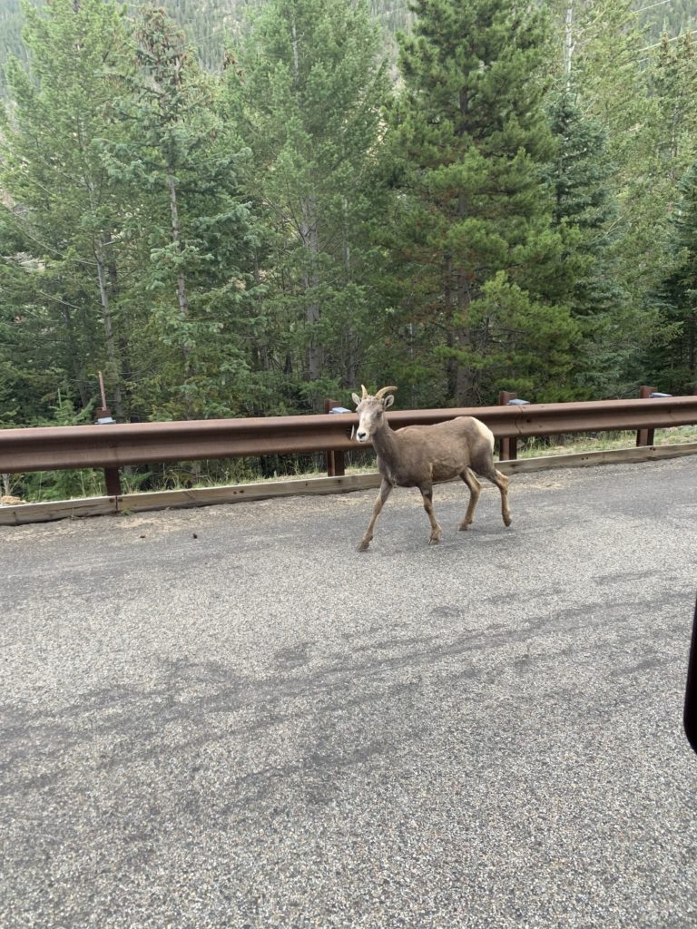
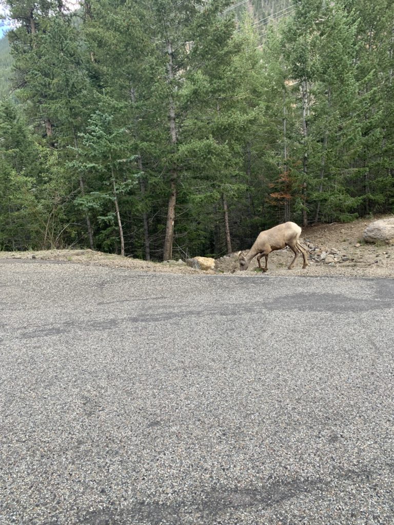
During the drive on Guanella Pass Road, I saw three sheep walking up the road and three more deer. That made the Argentine Peak and Mount Wilcox hike a good wildlife day: deer, sheep, pika, marmots and mountain goats.
Argentine Peak and Mount Wilcox – GPX Track


Max elevation: 13760 ft
Min elevation: 11214 ft
Total climbing: 4626 ft
Total descent: -4701 ft