
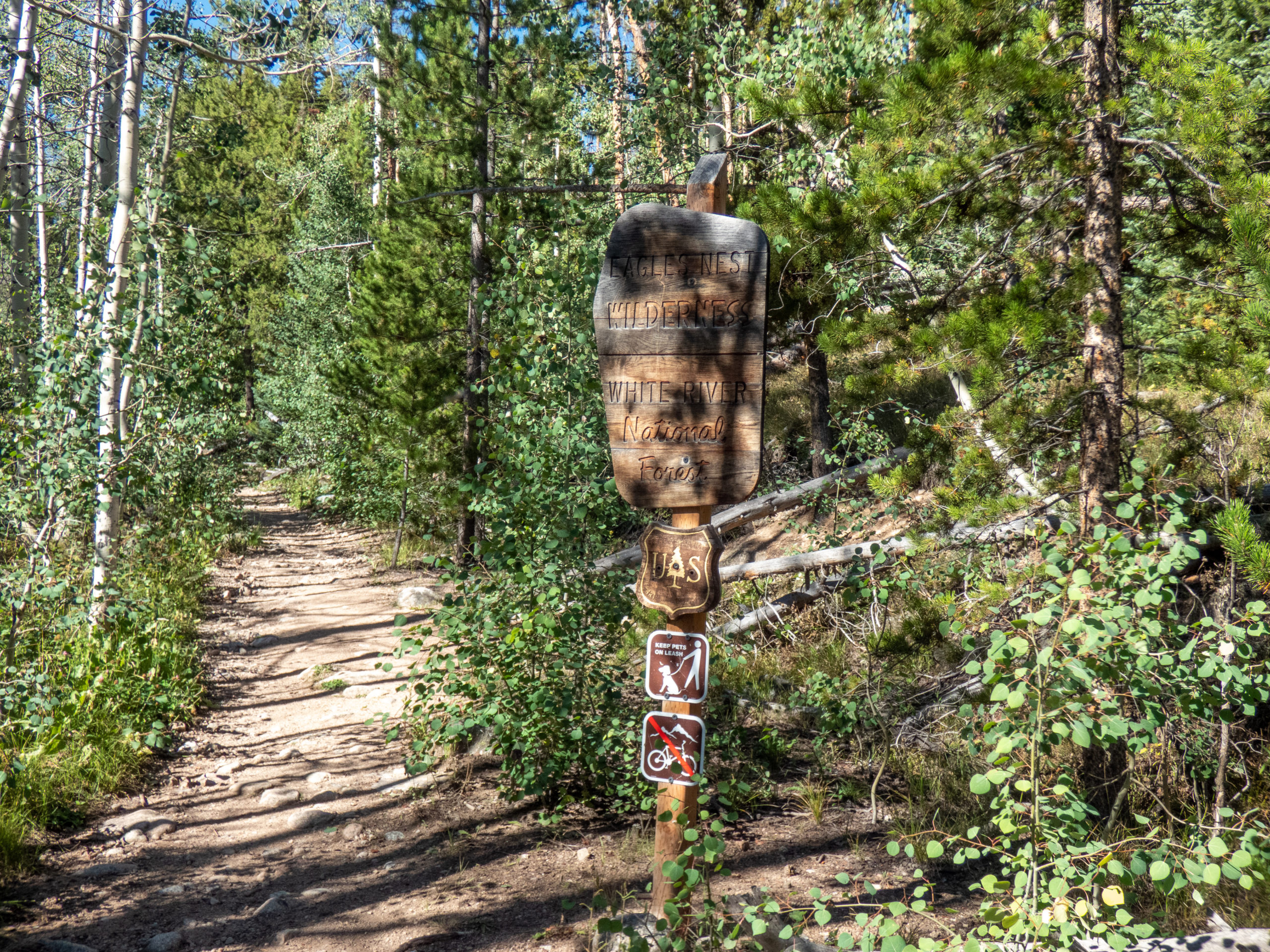
It’s hard to believe August was coming to a close already. I’d hoped to finish up with a few 14ers or another backpacking trip. After seeing the Upper Willow Lake from Red Peak, I decided backpacking up to them would be a good trip. An easier hiking route with more fishing seemed like a good way to end the month before Tanya and I head to Peru in mid-September.
Finding a starting point
Based on GAIA, it looked like starting at the Willowbrook Trailhead in Silverthorne would offer a nice 6-mile hike up to the lake. This shorter hike wouldn’t take all day, so I didn’t leave too early although I still missed the morning rush hour. Feeling excited to get out on the trail, I arrived at Willowbrook Trailhead and saw the “No Overnight Parking” signs. Hmmm, that wasn’t going to work for a backpacking trip. Thinking the overflow at the bottom of the hill might work, I headed back down there. Nope, no overnight parking there either. A quick check of my map showed two other nearby trailheads, one off Royal Red Bird Drive and the Buffalo Mountain trailhead I’d used to hike Red Peak. Of course, neither of these allowed overnight parking either.
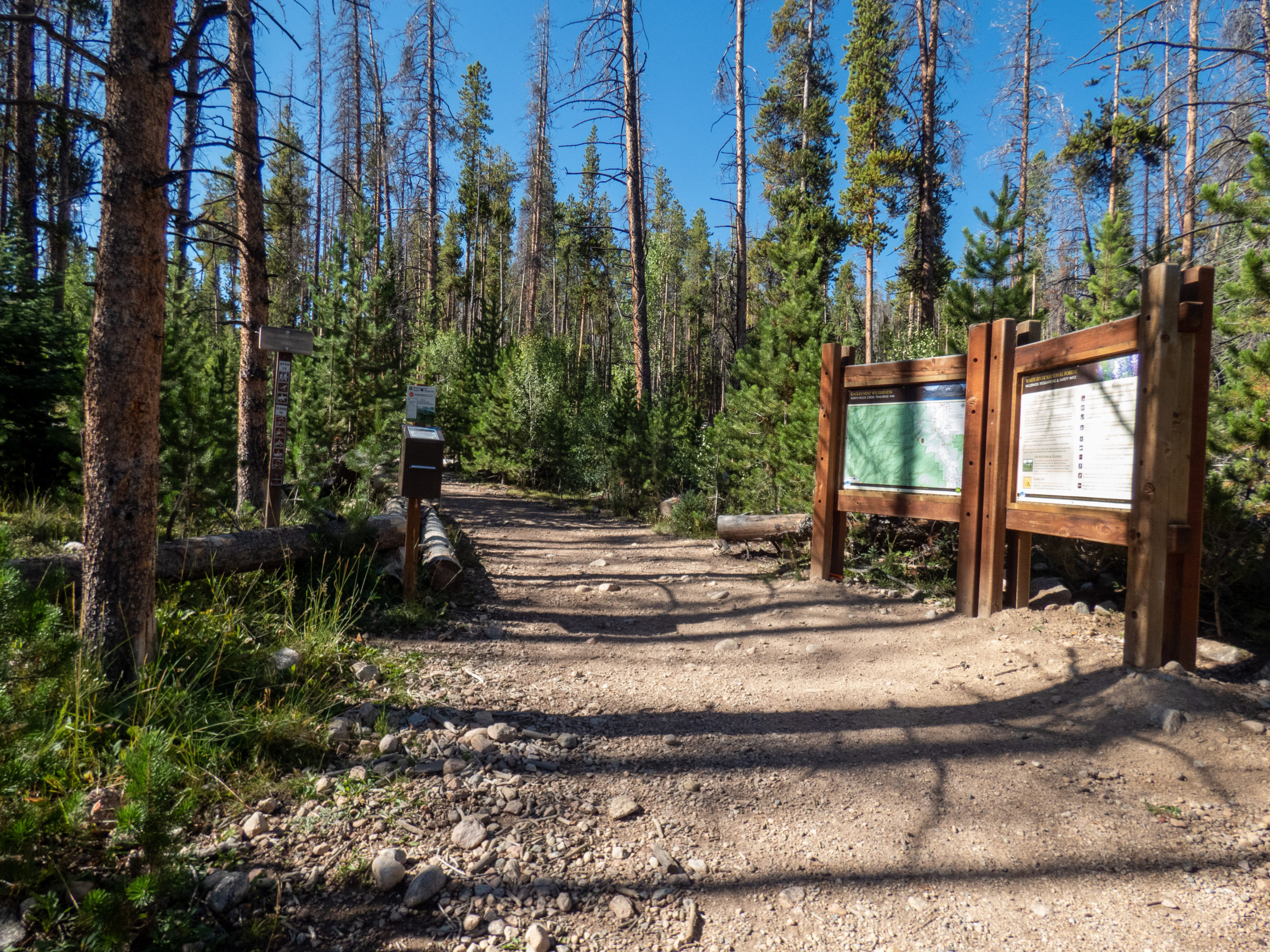
Realizing I didn’t have the knowledge I needed, I headed over to the Forest Service office in Silverthorne. Steve, a very helpful volunteer, let me know the city owns most of those parking lots and doesn’t allow overnight parking. He told me about the Rock Creek trailhead which most people used when backpacking into that part of the wilderness. It’d make my hike 8.5 miles instead of 6, still a relatively short hiking day. We chatted a bit more and I headed out to my new starting point. Thanks again to Steve!
Rock Creek Trailhead
Getting up to Rock Creek Trailhead was pretty straightforward. The initial road off Route 9 is a smooth dirt road. After 1.25 miles, you hang a left and it turns into a typical, rough 4WD road. It doesn’t take a 4WD to get there, although a vehicle with low clearance would need to avoid several potholes and rocks in the road.
By 9:45, I was at the trailhead and anxious to be hiking. It was warm, about 62. The weather looked great so I donned my pack, hiking boots, and headed out.
Navigational errors
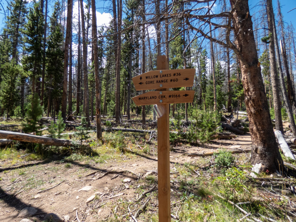
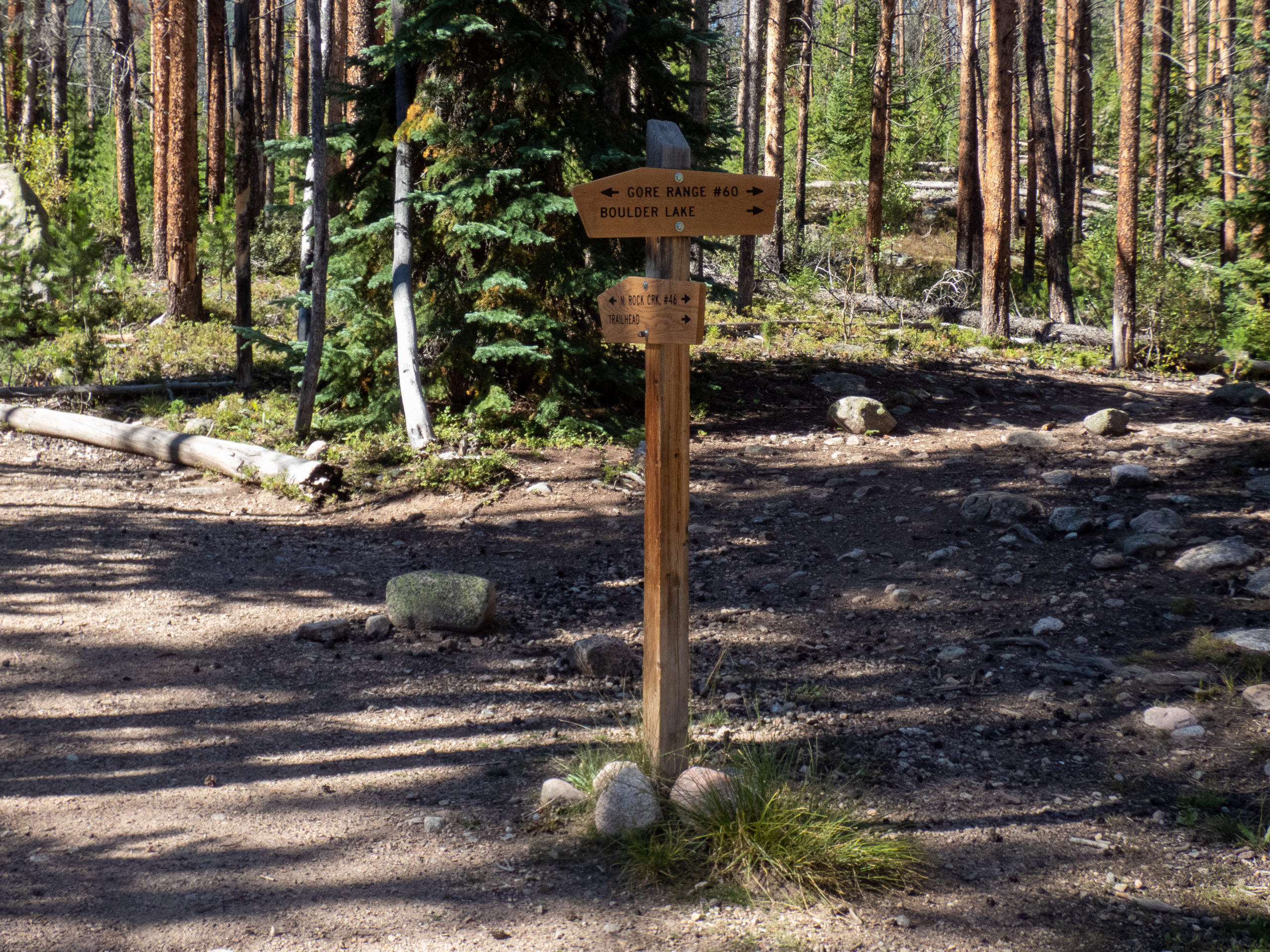
It is really hard to make navigational errors when hiking on well marked trails. I still seem able to do it though, and did it pretty early on this hike. The Rock Creek trail leaves the parking area and within .5 mile, meets the Gore Trail. This is where I was supposed to make a left. I took a picture of the signs, and happily continued straight on the Rock Creek trail. Within .25 miles, I realized my mistake and headed back to the sign, saw the obvious Gore Trail and headed south. What an idiot…typical.


Gore Range Trail
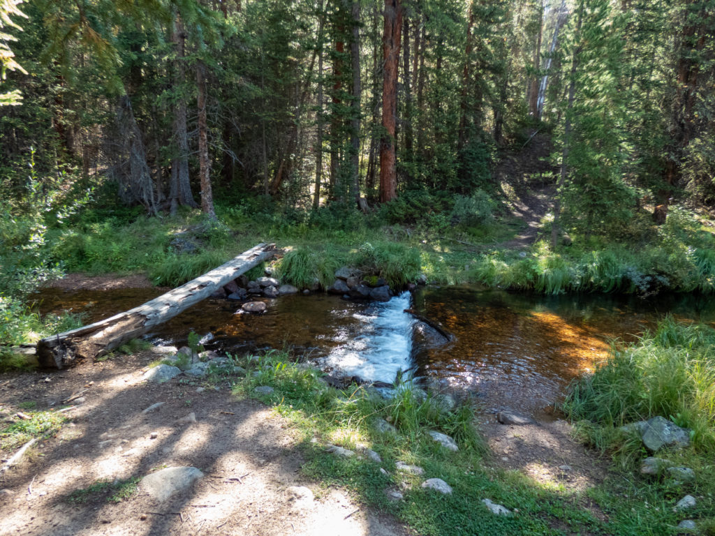
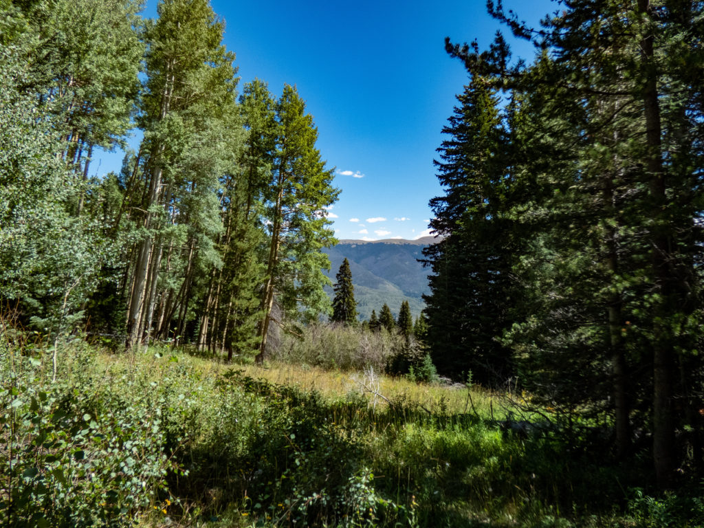
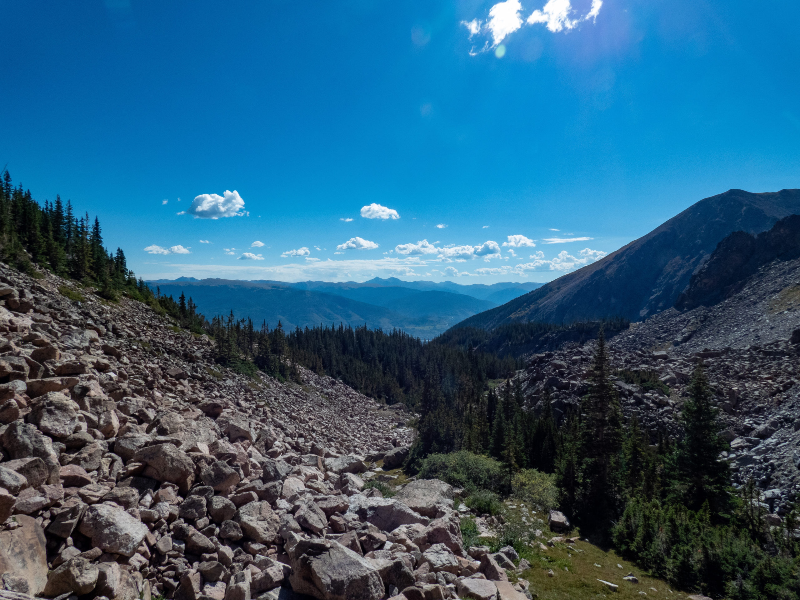
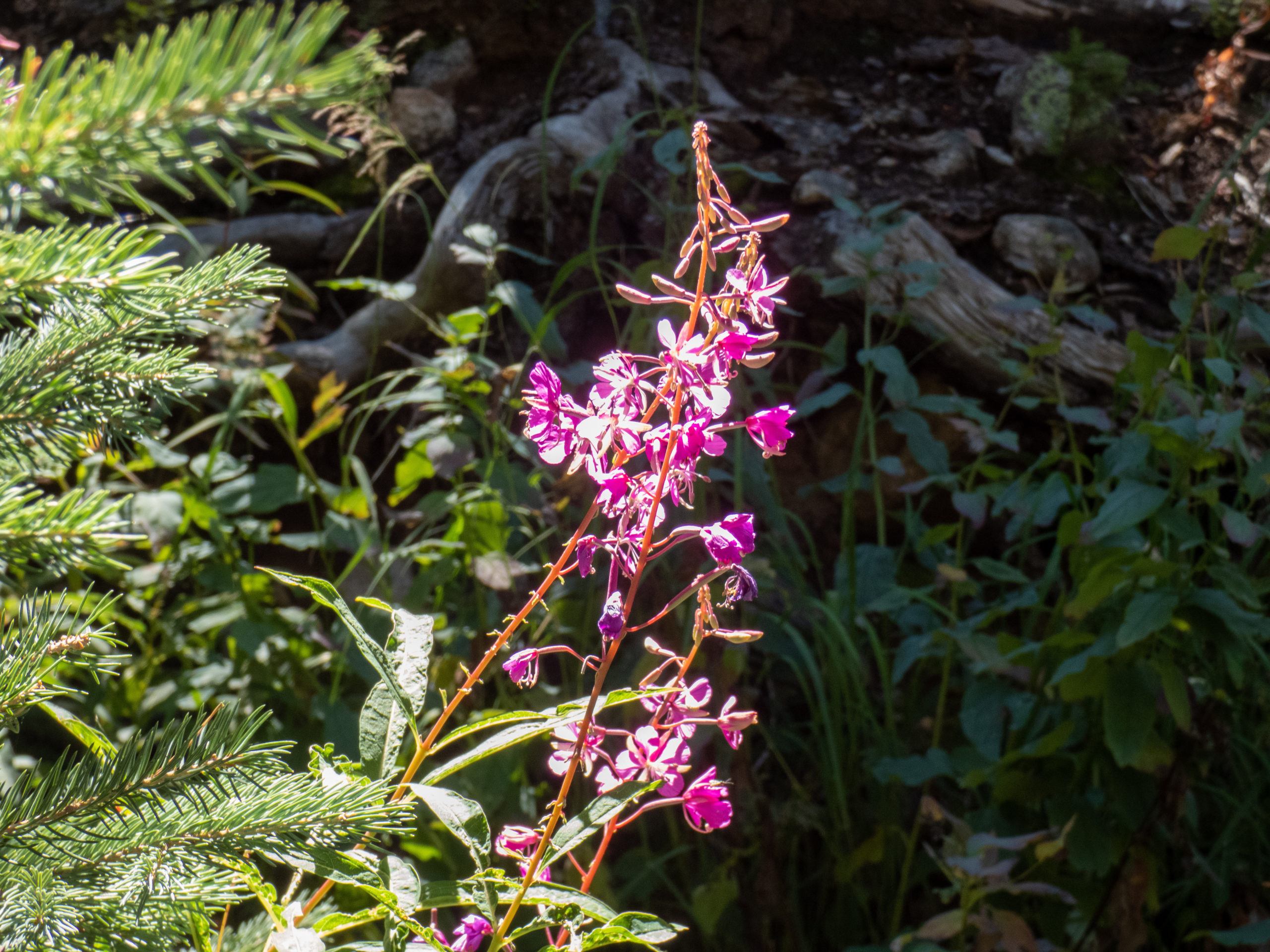
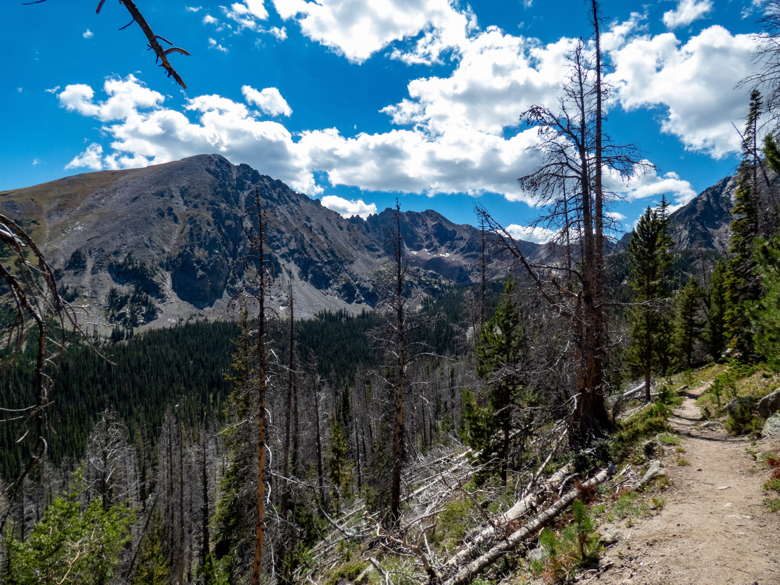
The Gore Range Trail is a fairly easy hike without too much elevation change. The stream crossings for the North Rock Creek is pretty with nice views across a meadow into the mountains. The South Rock Creek crossing also pleasant with the sounds of rushing water off to the right. This stream is right before reaching an unnamed pond covered in lily pads.
GAIA shows trail #60 branching off from the Gore Range Trail at mile 3.2. It’s apparently an old trail that no longer exists. I looked for it and saw a faint track (or what I thought was one) and decided against taking it. The last time I bushwhacked in this area it was pretty hard. This section didn’t look as bad…but why risk it? I wasn’t in a hurry and was happy to stay on the well-defined trail.
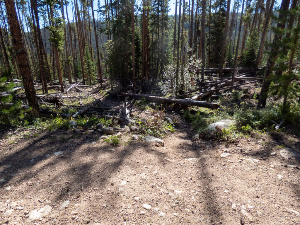
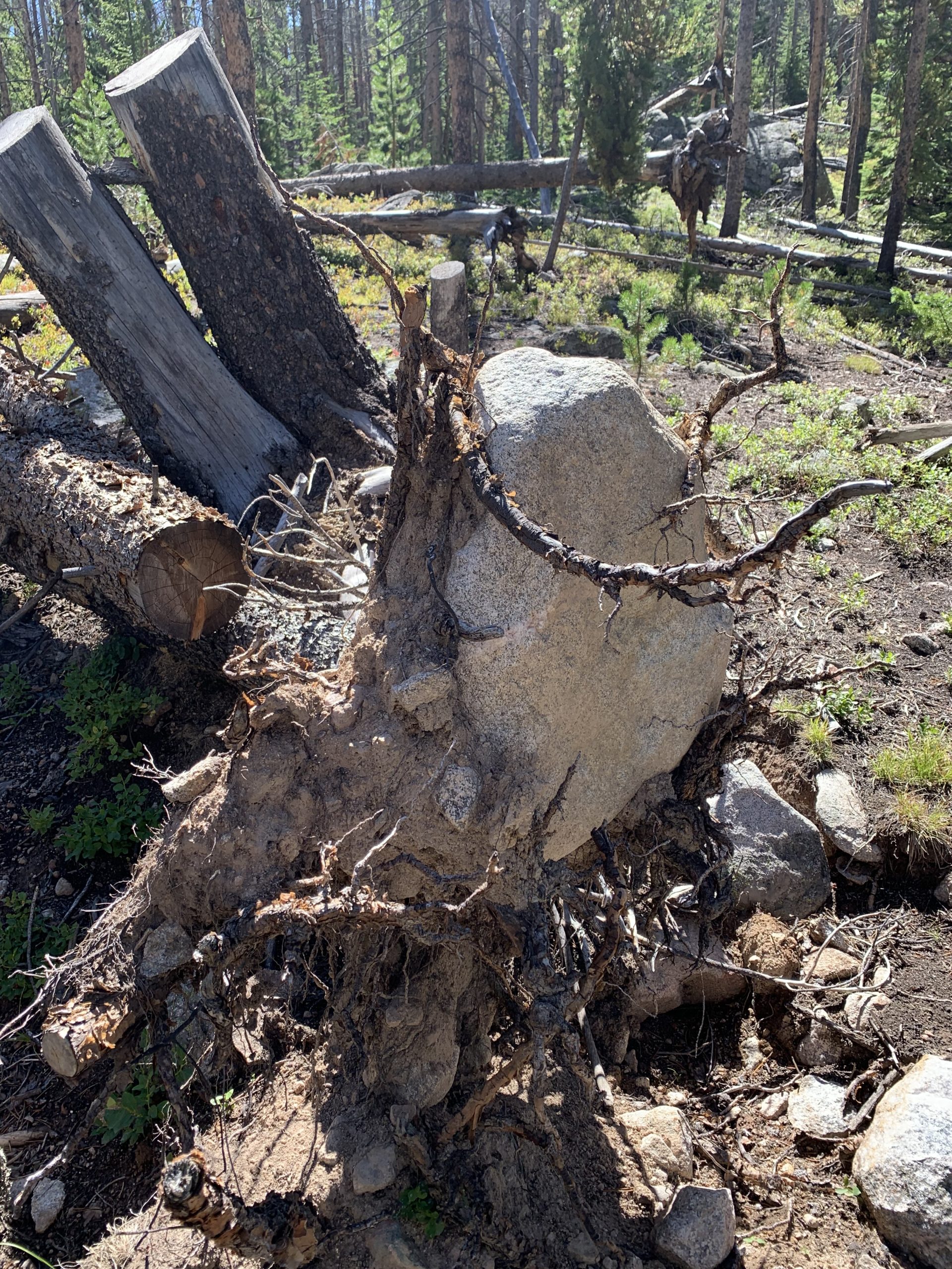
The Gore Range trail in this area isn’t an amazing hike. The first part was well forested and pretty. As I went on, there were large sections of downfall from beetle kill followed by wind. These sections were hot and not that pretty, with plenty of grasshoppers. The forest is recovering, however, with many small spruce trees and plenty of grass. It’s less of an interesting hike.
I encountered 6 horses on the trail shortly before intersecting with Willow Lakes trail. Three of the horses had riders, the others were packing food and supplies. Then, at the junction with Willow Lakes, I met three Forest Service employees. They had been replacing the sign and noted that the Maryland Creek sign was incorrect, which didn’t really matter to me. 🙂 We chatted for a while and then headed up to the lakes using the Willow Lakes trail.

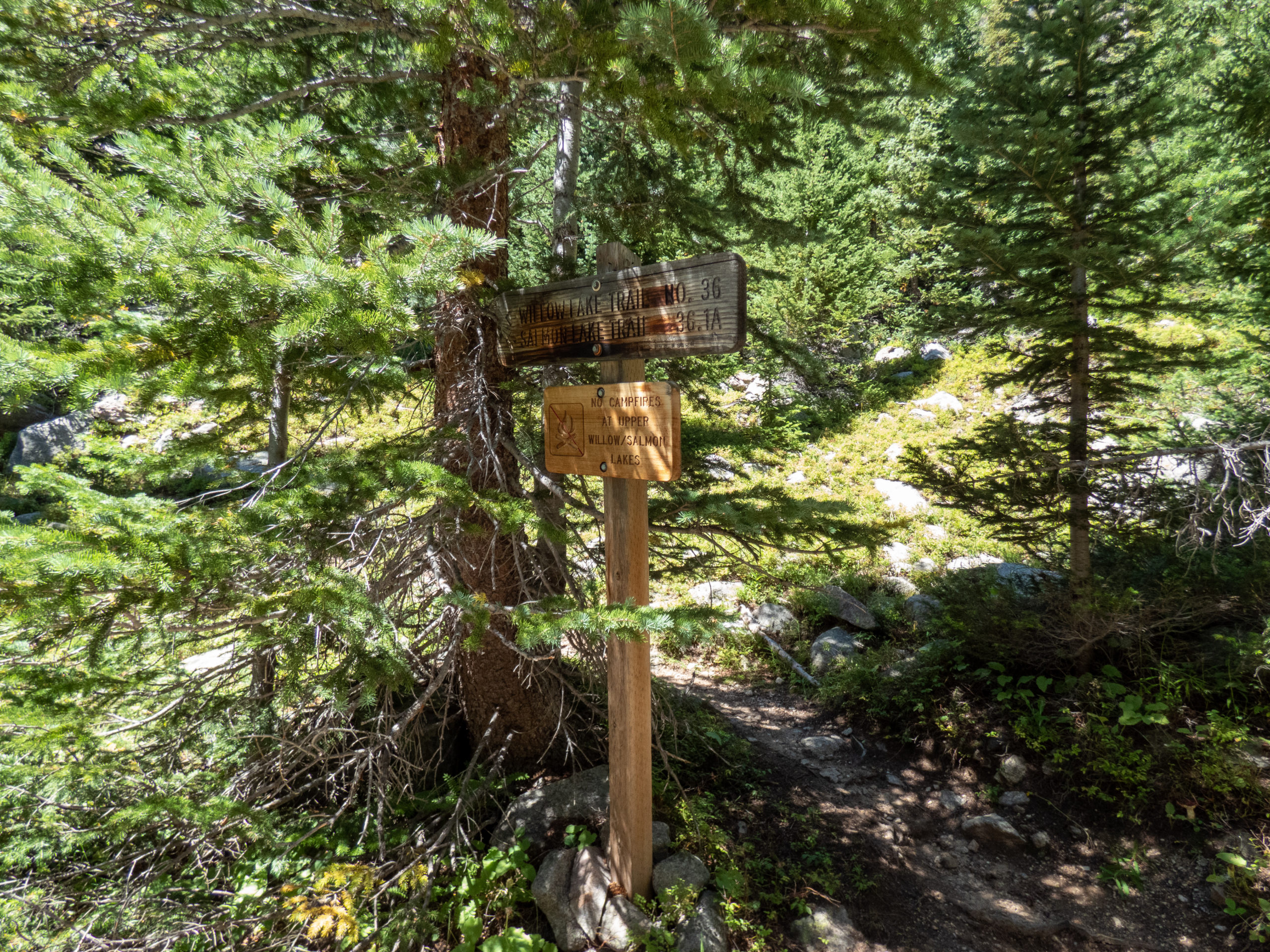
Willow Lakes Trail
While the trail incline increased on Willow Lakes Trail, it still wasn’t bad at all. I checked for the end of the previously noted trail #60 at the sharp turn on Willow Lakes trail. Here there were more obvious signs of an old trail with some logs across the entrance to discourage use. Maybe I’d take that route back…a decision for Future Rob.
The trail came to the branch for Salmon Lake, another popular destination in the area. As I continued on, I met a couple coming down from Upper Willow Lake. They were friendly and mentioned there were goats up at the lake along with plenty of fish rising. This got me a little excited to get there. Shortly after that, I met another couple who said the same thing. I thought it would be pretty cool to see plenty of mountain goats again.


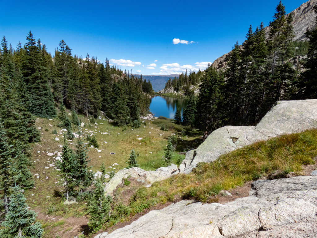
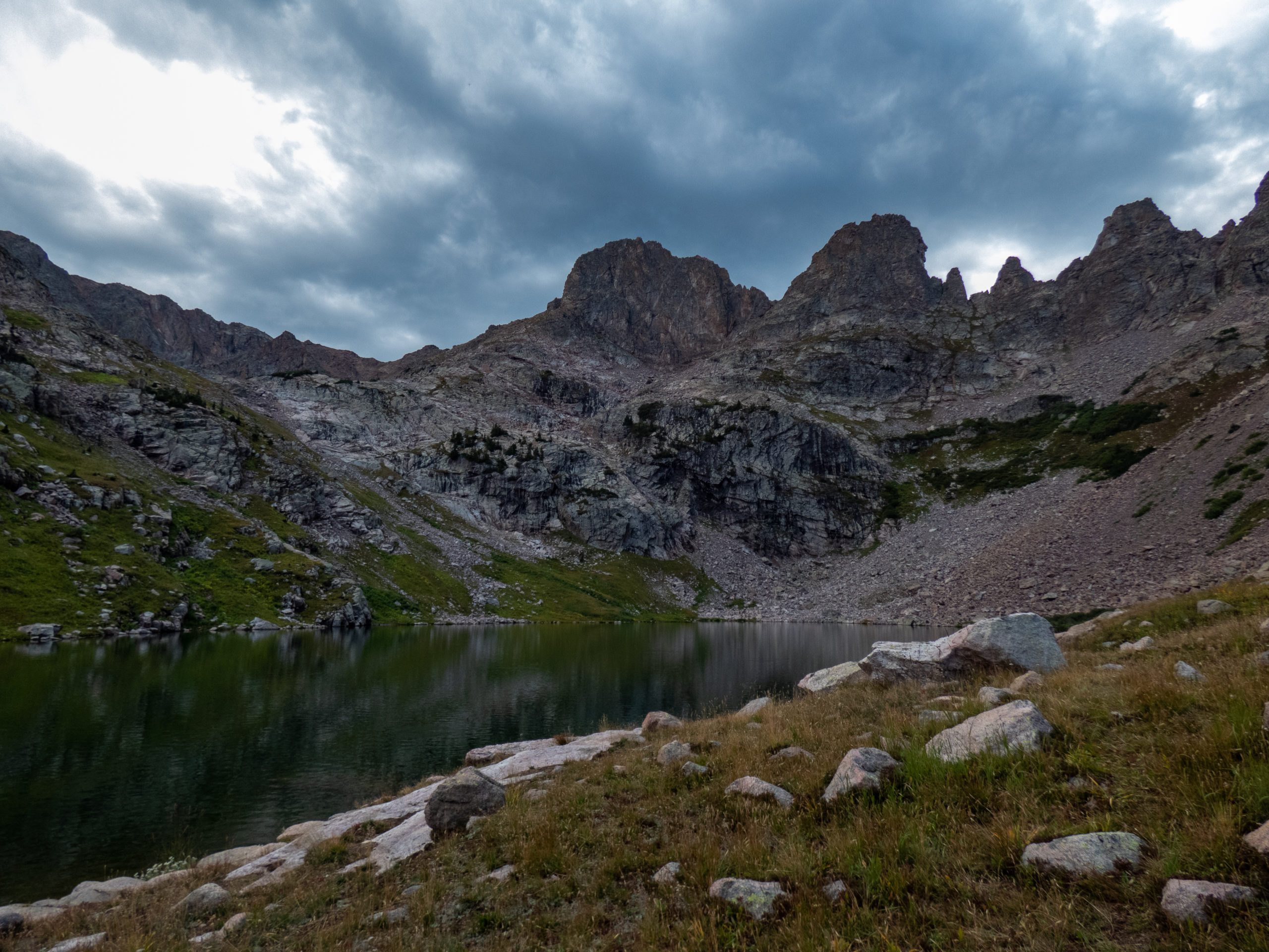
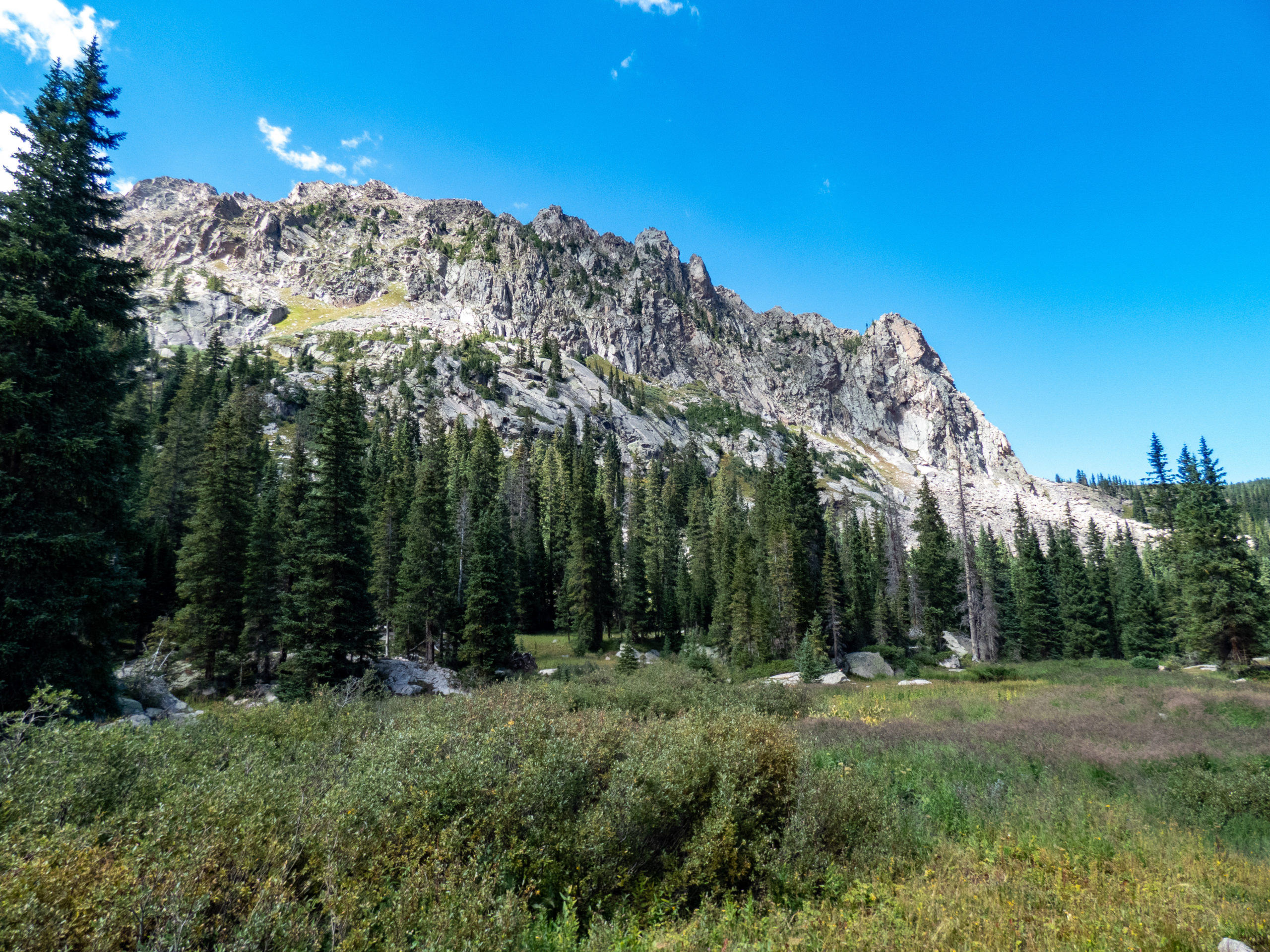
Upper Willow Lake
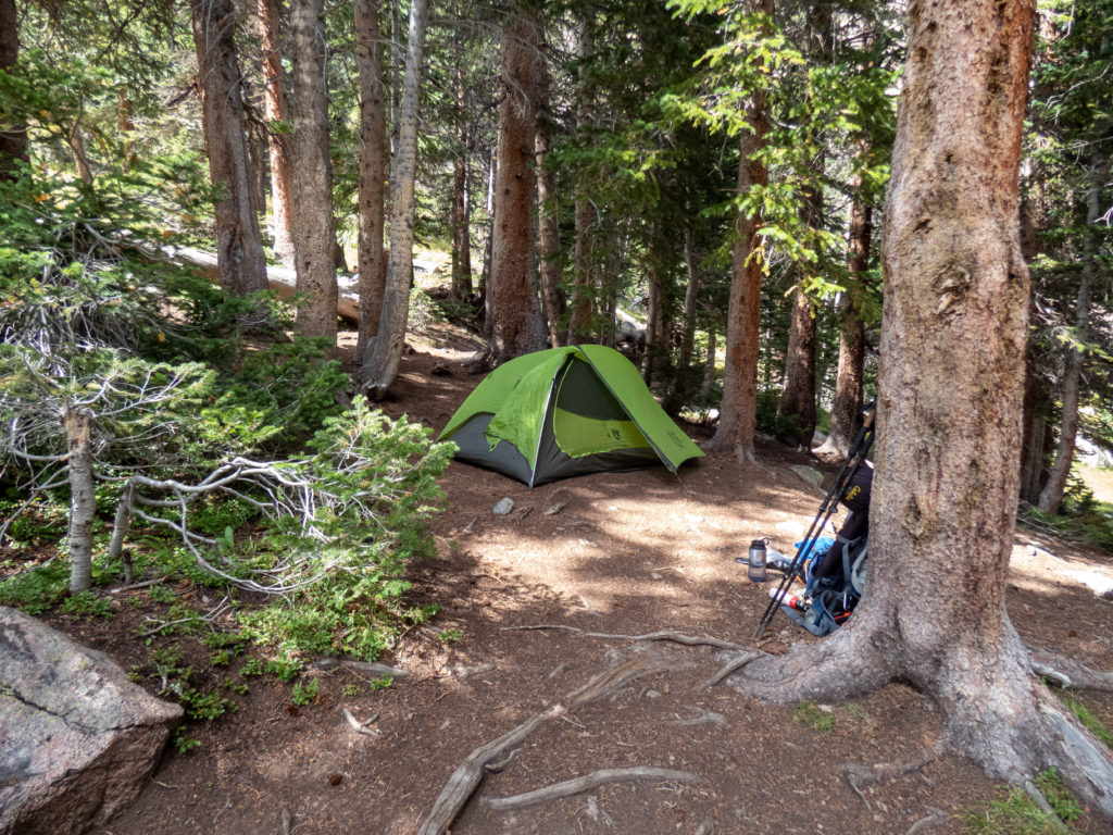
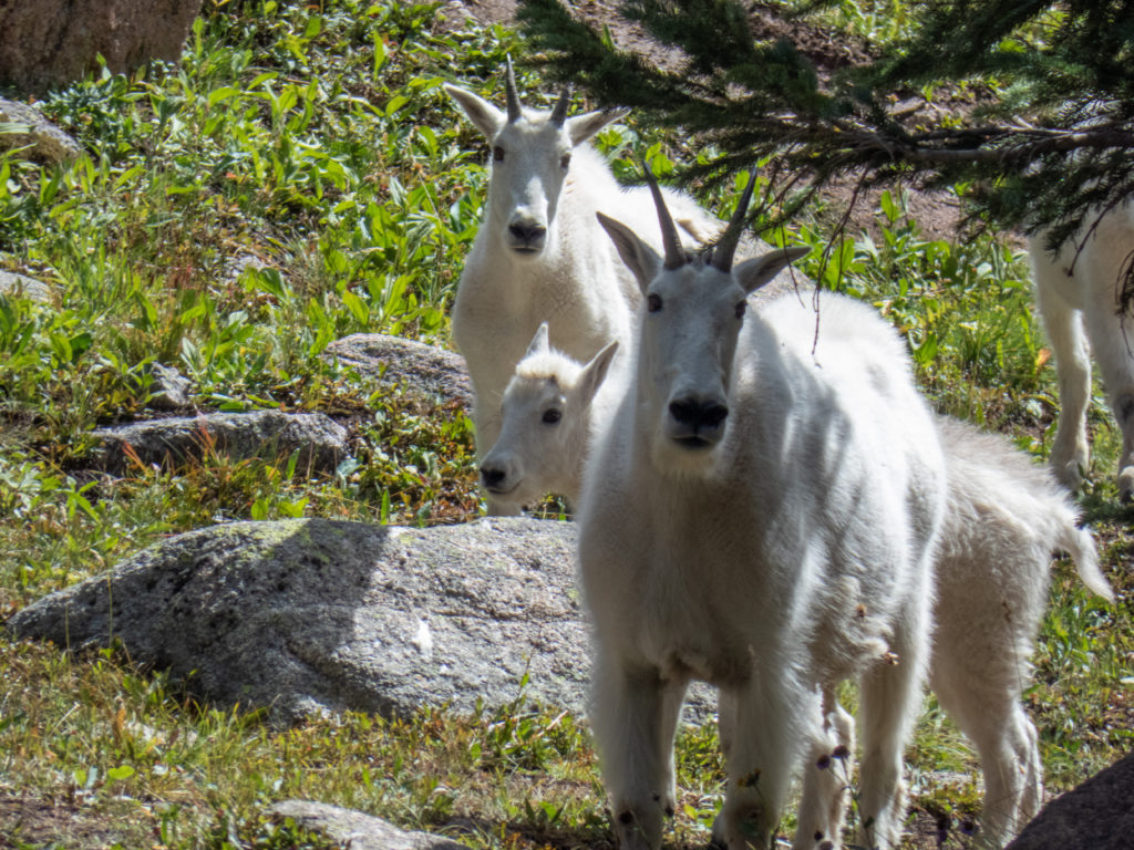
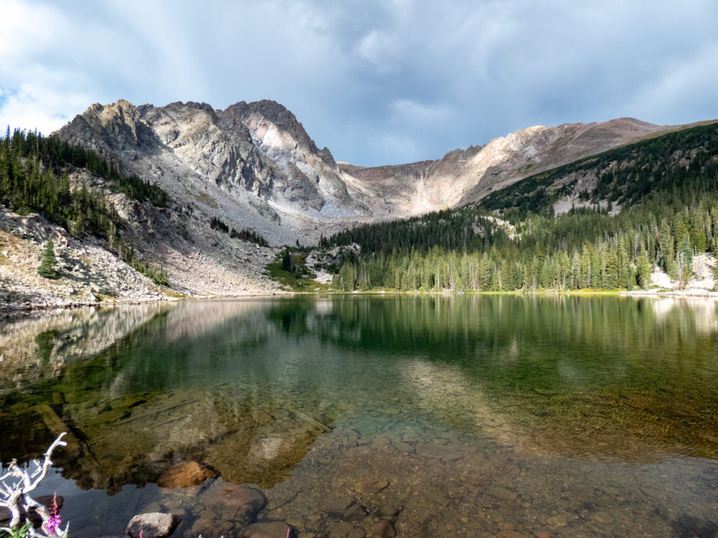
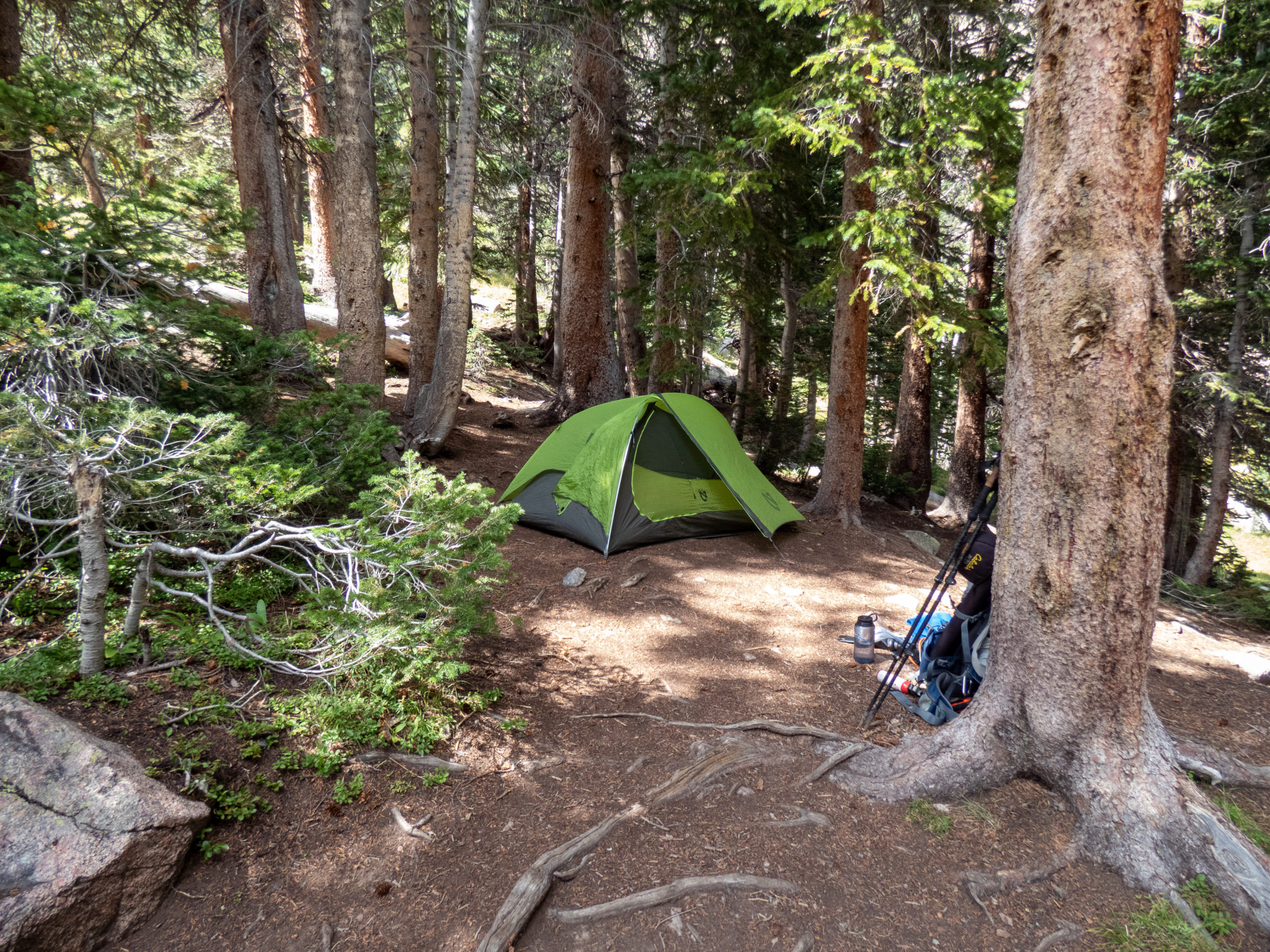
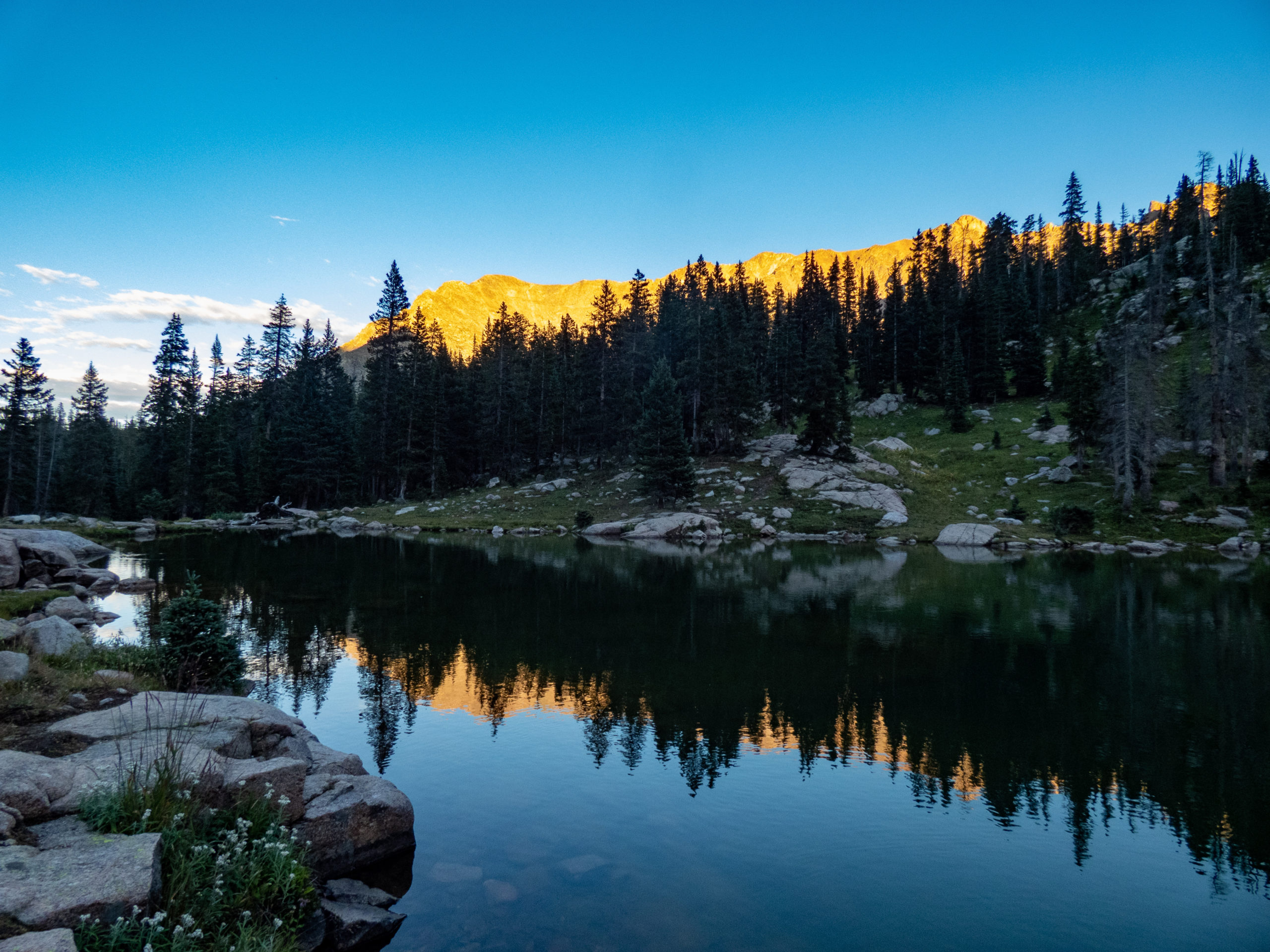
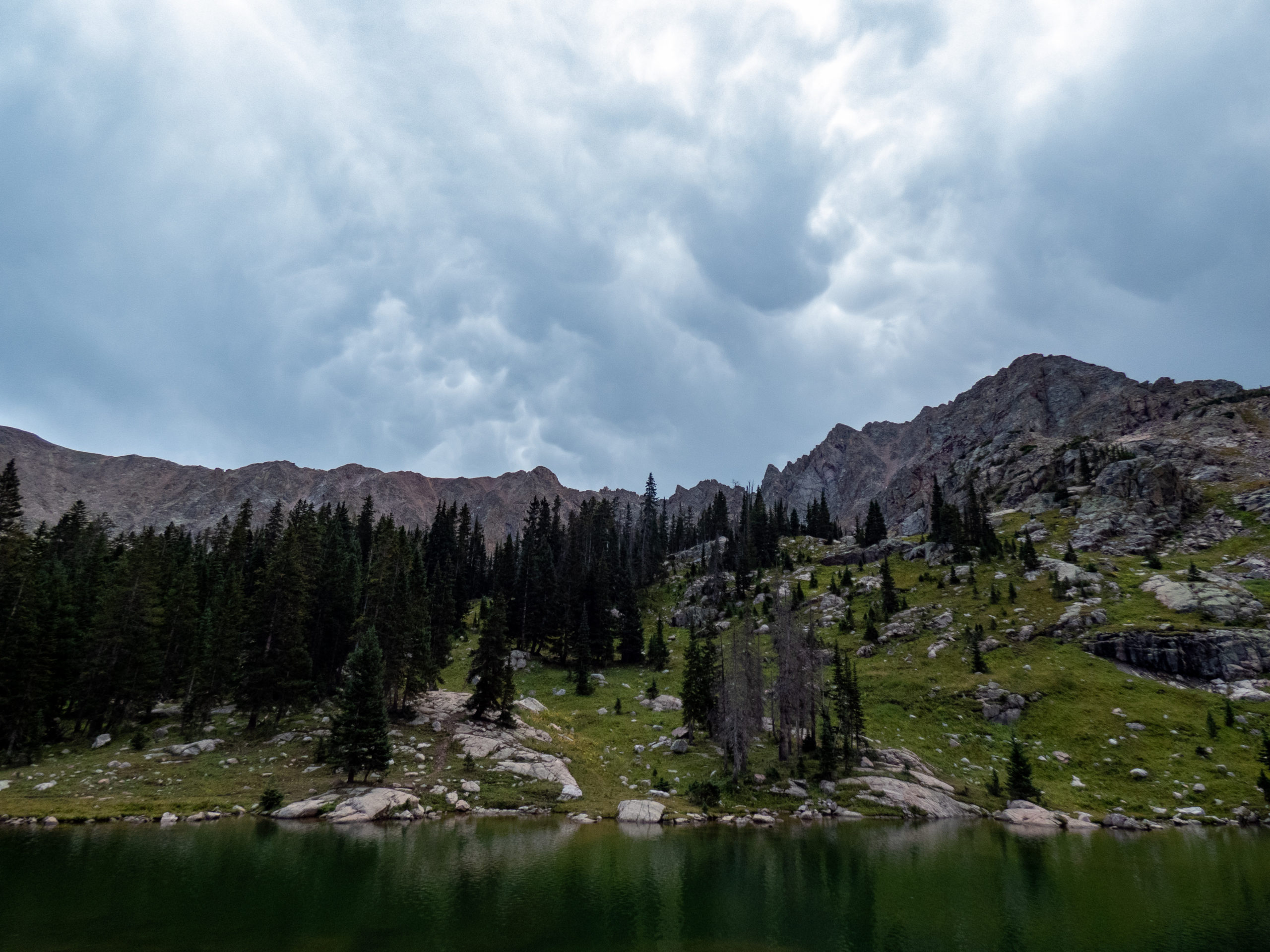
The trail passes by several lower lakes. As you approach Upper Willow Lake, the trail crests a small rise and you have a great view of the cirque housing the lake. I saw a great camp spot and headed directly to it to make my home for the next few nights. Within a short time, goats were in my camp.
I was a little surprised by the size of the goat herd, almost 30 of them. They were happily wandering around the lake so I took several shots. As I was setting up camp, they decided to get a little too nosy for me. I had to shoo them out of the camp several times. This was my first indication of a “goat problem”.
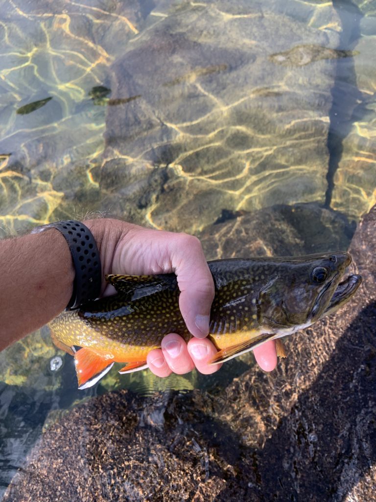
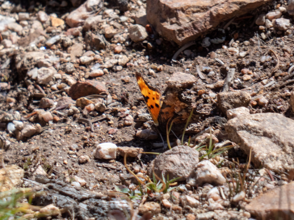
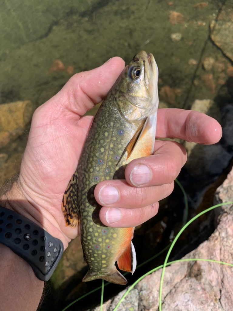
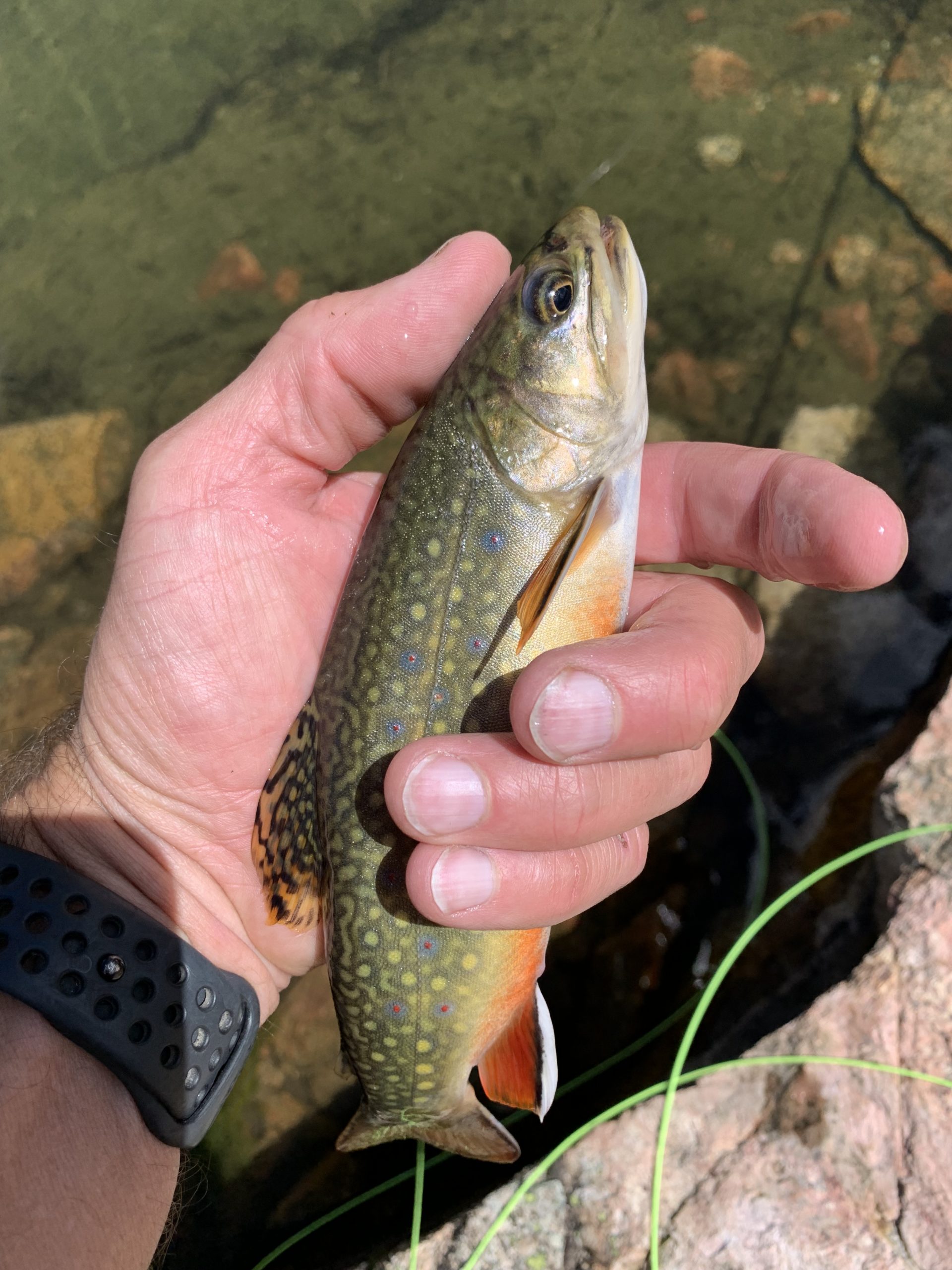
There were lots of fish rising so I got out my fly road. There were many times where I had a fish on with every cast, then things would slow a bit, then go crazy again. It was great fishing! The fish were hitting both elk-hair caddis and humpy royal flies. It seemed like they hit the humpy royals a little harder, although both were effective.
The Goat Problem
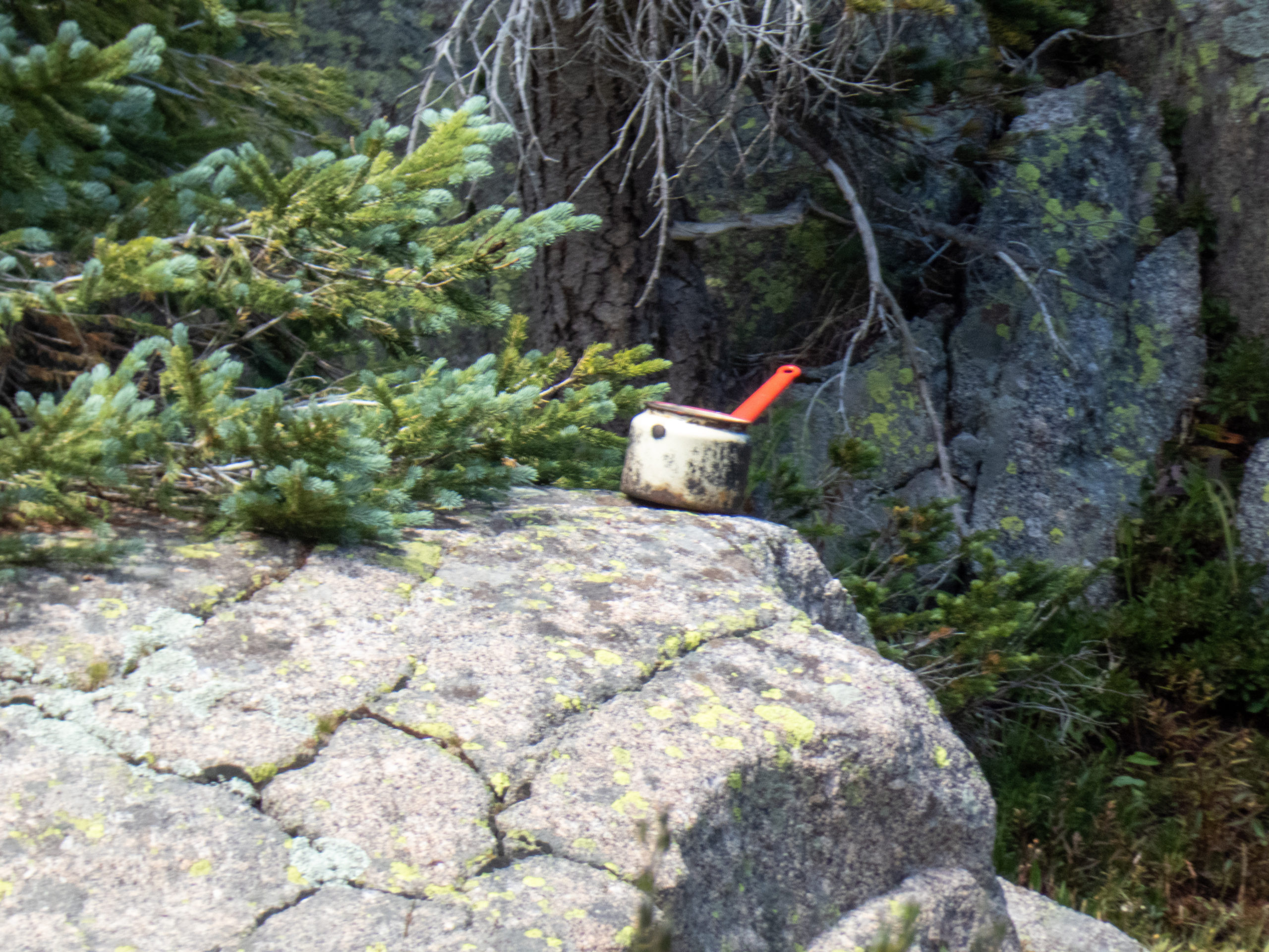
As I headed back to my camp, I noticed goats by my tent. It turns out a few of them had pushed my pack from where I’d stored it, and were licking the foam pads, apparently for the salt from my sweat. They’d also be licking my trekking pole handles. Nothing like a bunch of goat spit on your equipment to let you know you’re out in the woods. Obviously that stuff was going to have to dry out before using it again. I wiped off as much goat slobber as I could and hung everything up in the trees, out of reach. Note to self, goat-proof camp from now on!
The rest of the evening progressed uneventfully with some more fishing and dinner in camp. A few day hikers came up and made for good conversation. One other man was camping up there and we chatted for quite a bit, discussing various climbs and hikes in the area. He was headed out the following morning so that was the last we talked.


Upper Willow Lake – Day 2
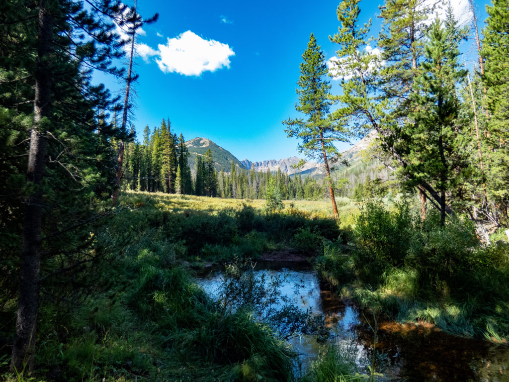
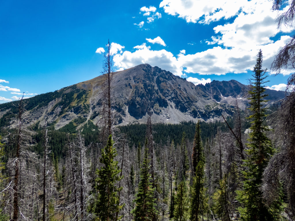
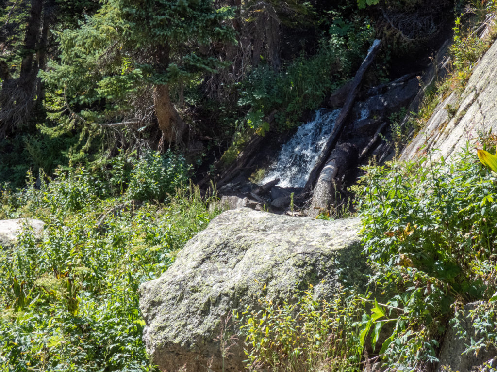
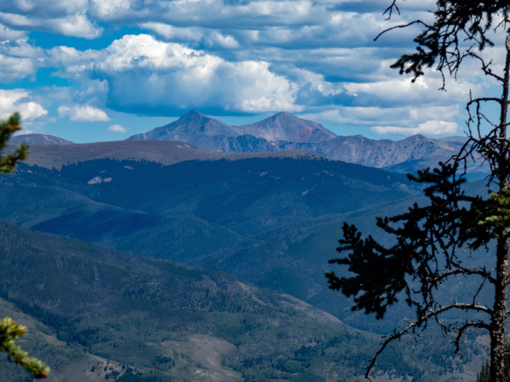
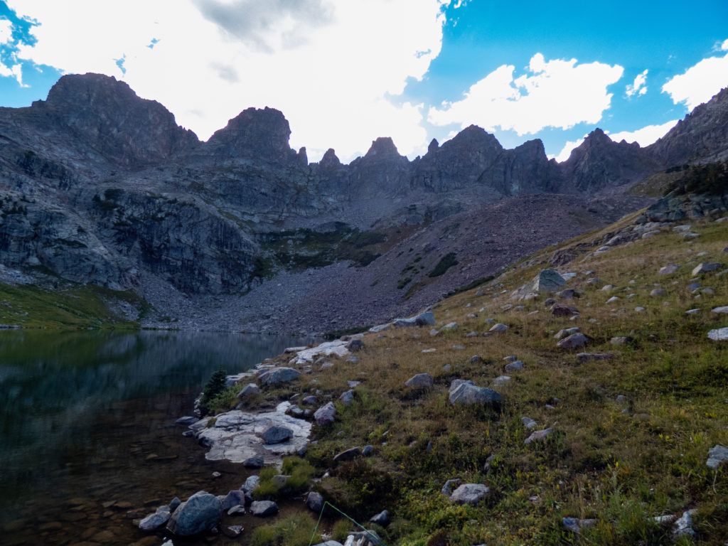
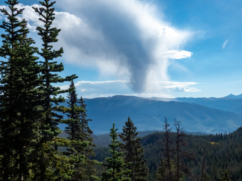
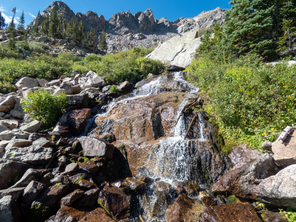
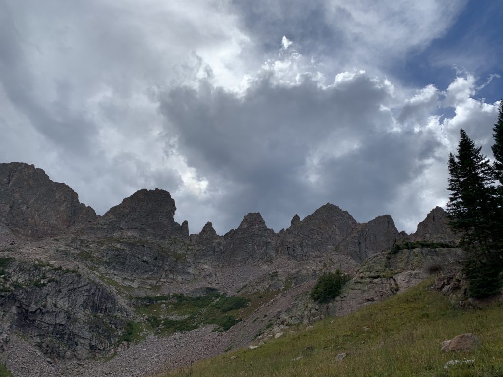
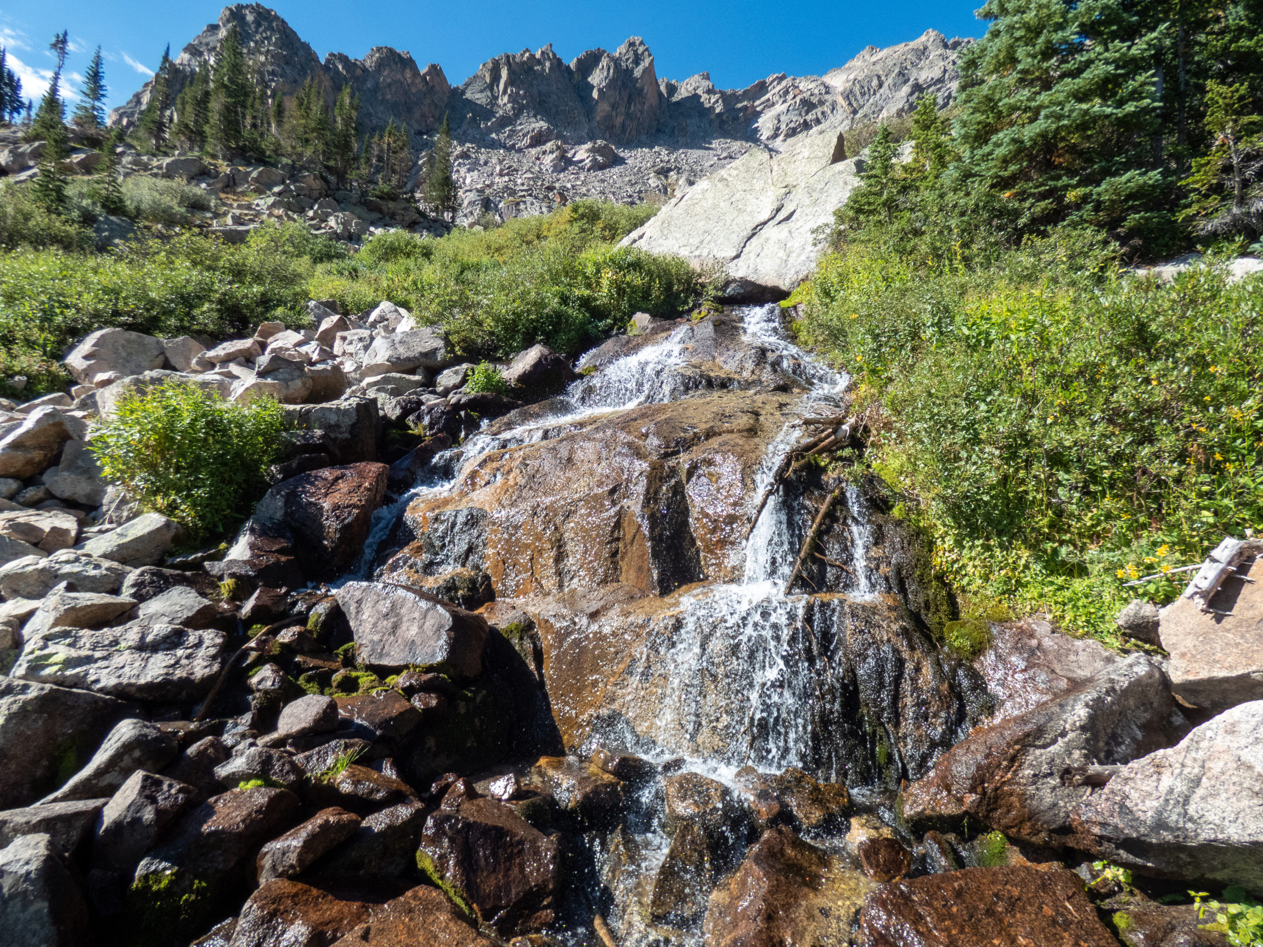
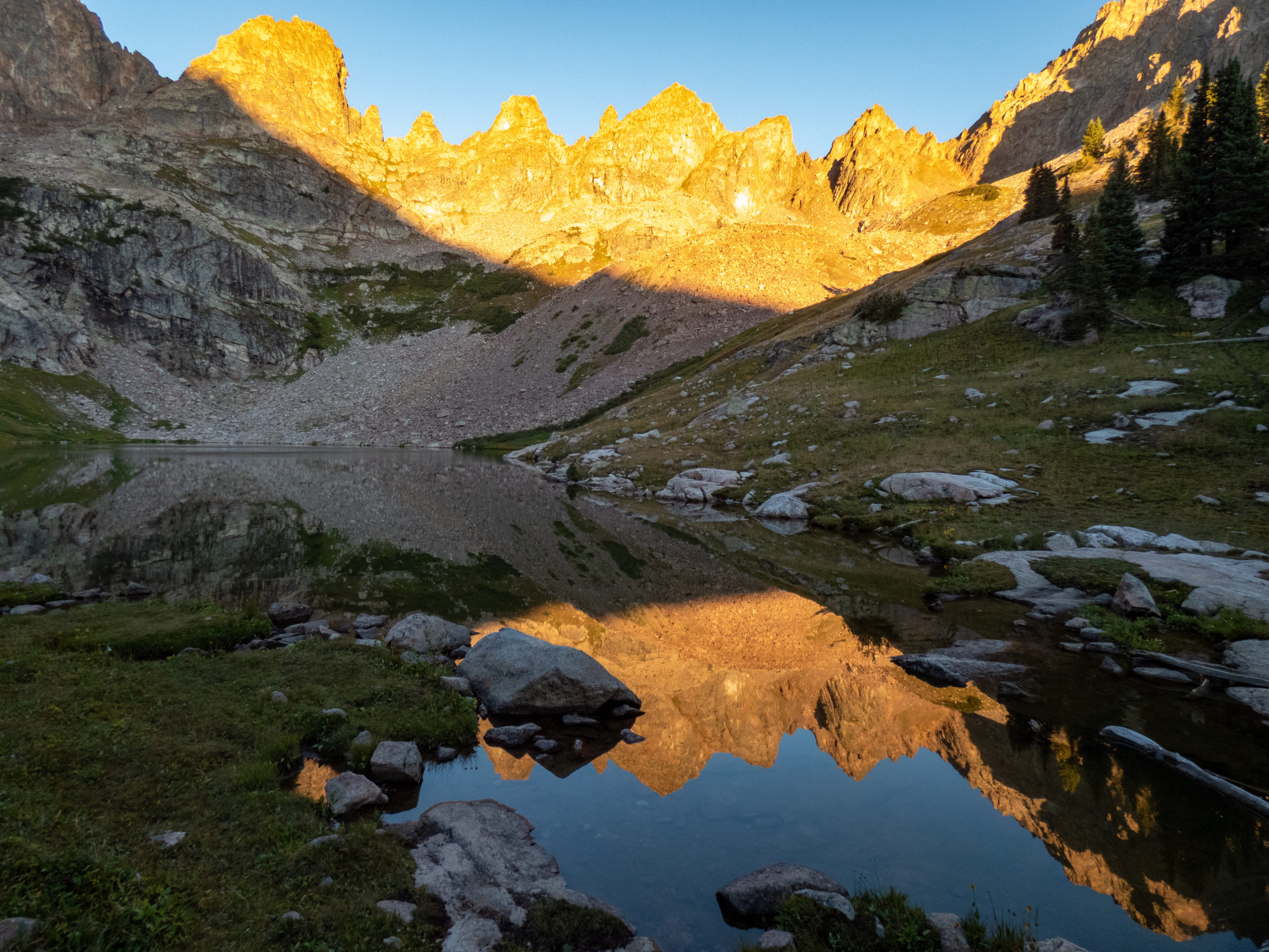
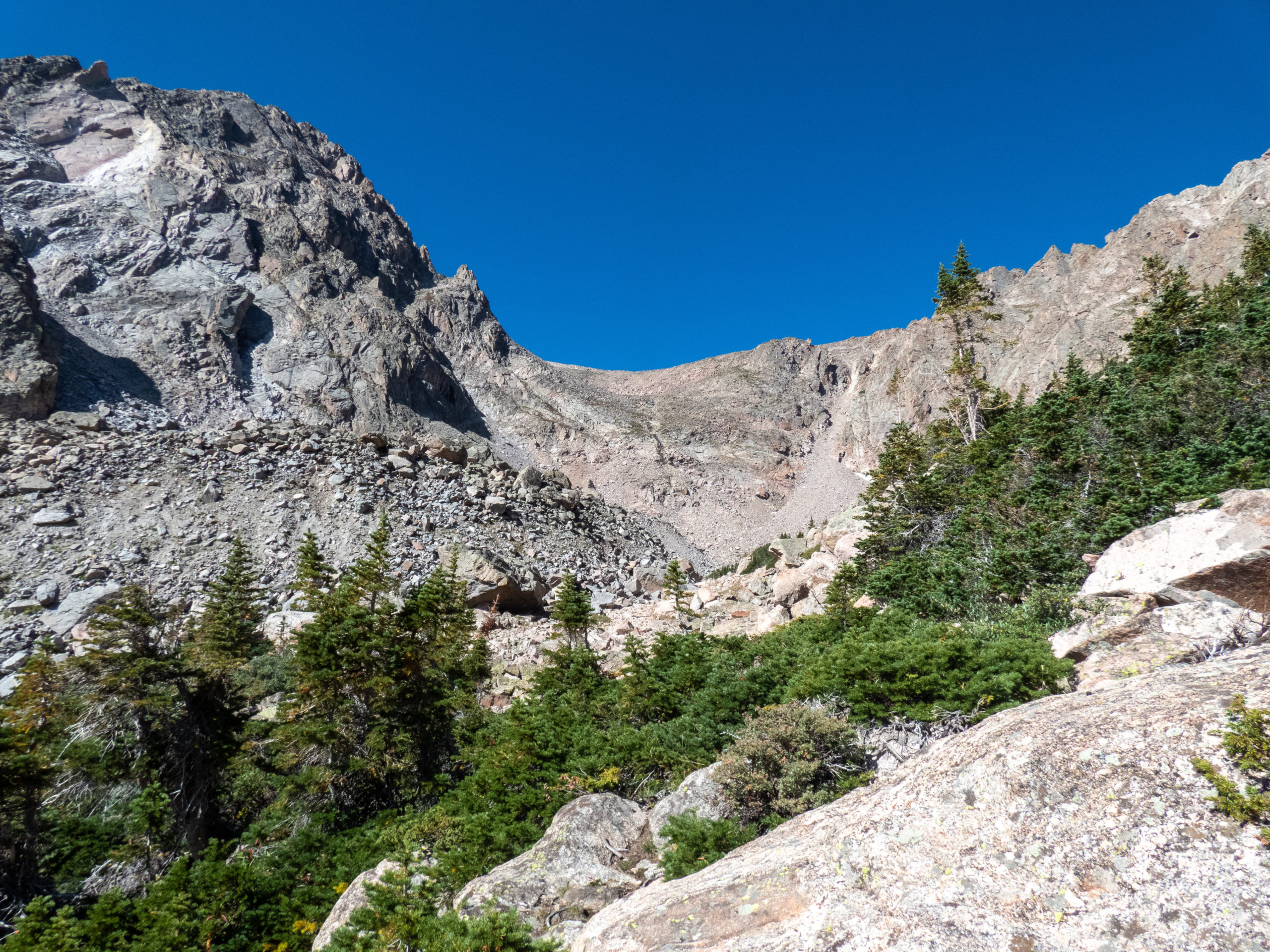
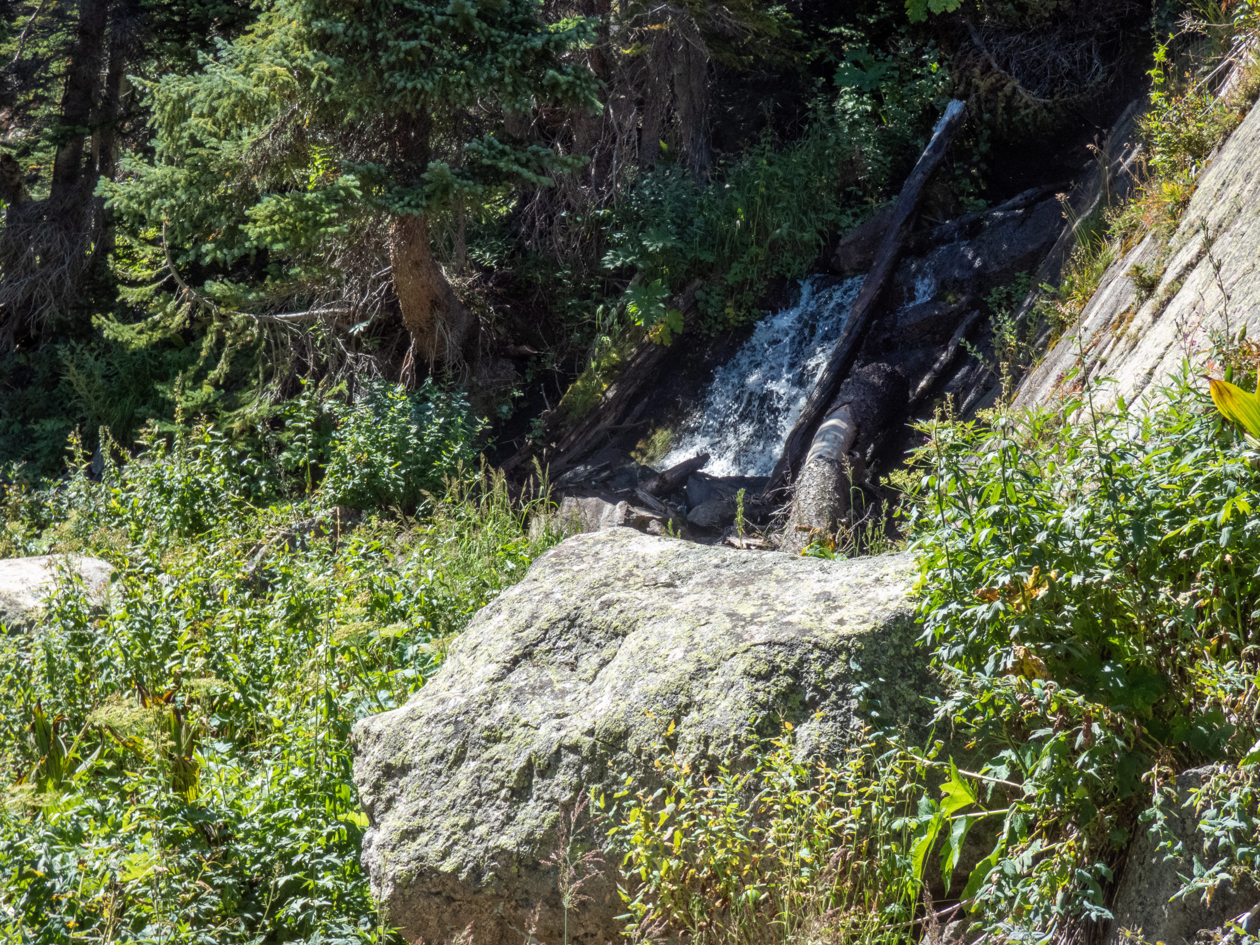
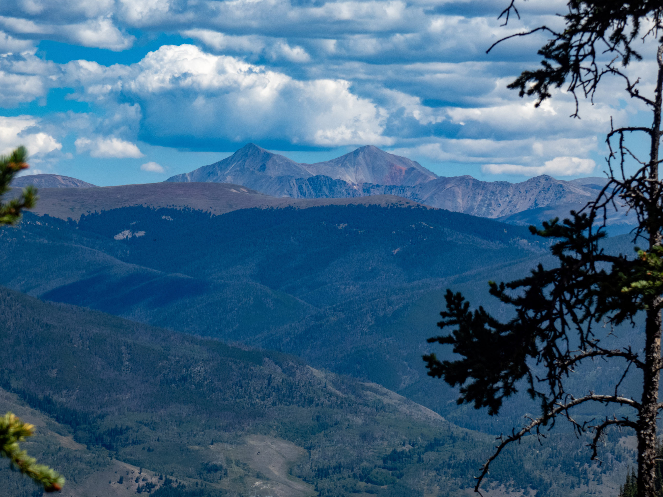
Mount Silverthorne rises to the north of Upper Willow Lake and had been on my plan to investigate, and maybe summit. While hiking along the trail, I spotted a rain shower to the east in the Ptarmigan Peak wilderness area. The formation of the clouds was really interesting and made for a great pic. Glancing back west, I did see some clouds coming over Mount Silverthorne and thought I might get a shower myself. It also gave me pause about pushing the summit as I wasn’t sure what weather was headed my way. Continuing on, I came to the waterfall I’d seen the day before and left the trail to scramble over a boulder field taking me directly to Salmon Lake.
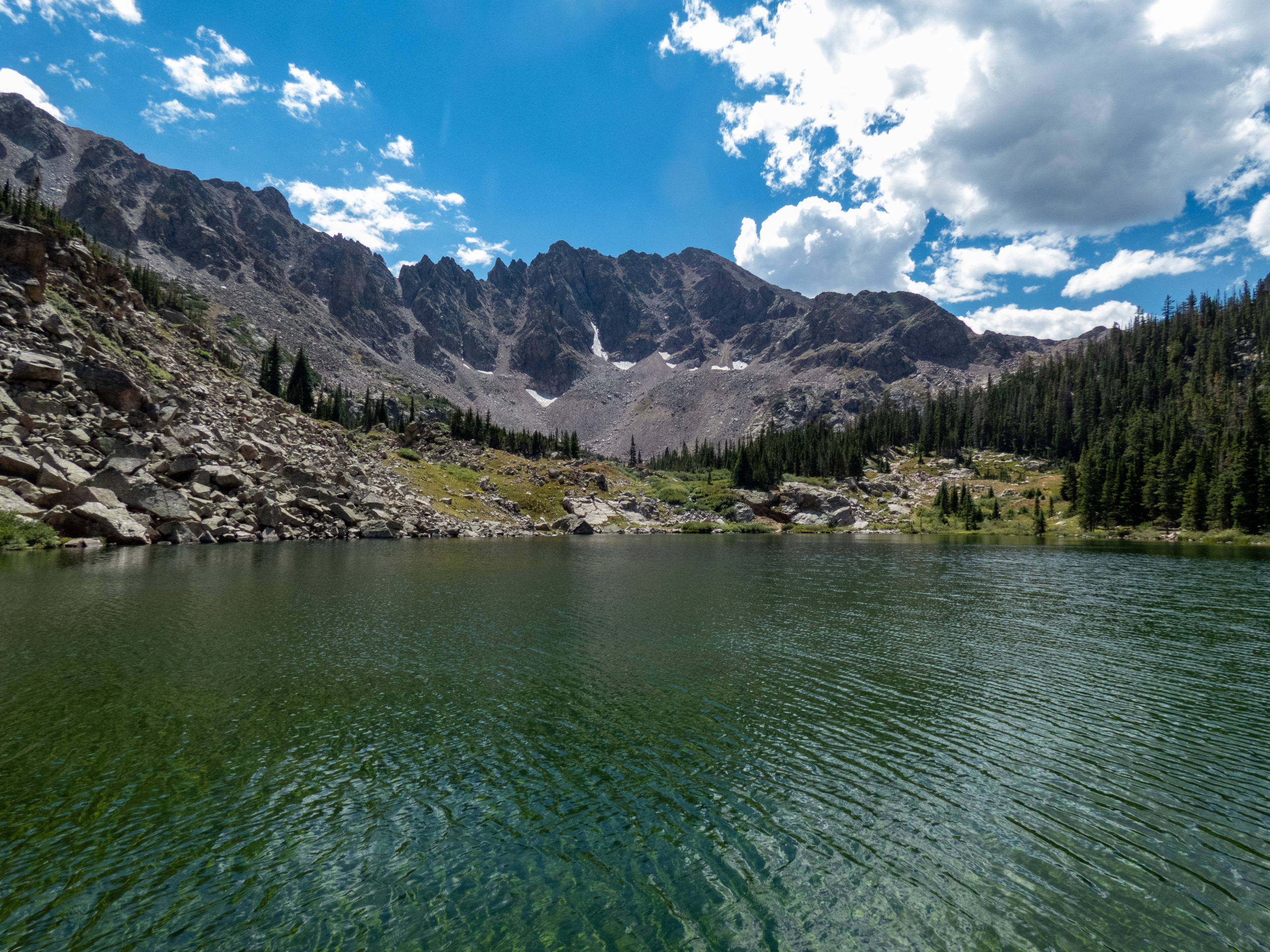
Once at the lake, the view of Mt. Silverthorne was beautiful with some clouds above it. The clouds looked like they might have some rain in them so I decided to fish for a bit to see what happened with the weather. I was able to catch some larger fish at this lake. They were a little further out making it a little difficult to fly cast out far enough. The backcast area was filled with plenty of trees and shrubs grabbing at any nearby fly.

Continuing up
It didn’t take long for the clouds to clear out. I packed up my rod and scrambled over a large boulder field to the trail north of the lake. This trail loops around to the west where there are several nice campsites near North Willow Creek. It might make a good destination on some other hike. I followed the creek up climbing over various boulders and following social and animal trails. The climbing was fun and the weather was gorgeous.
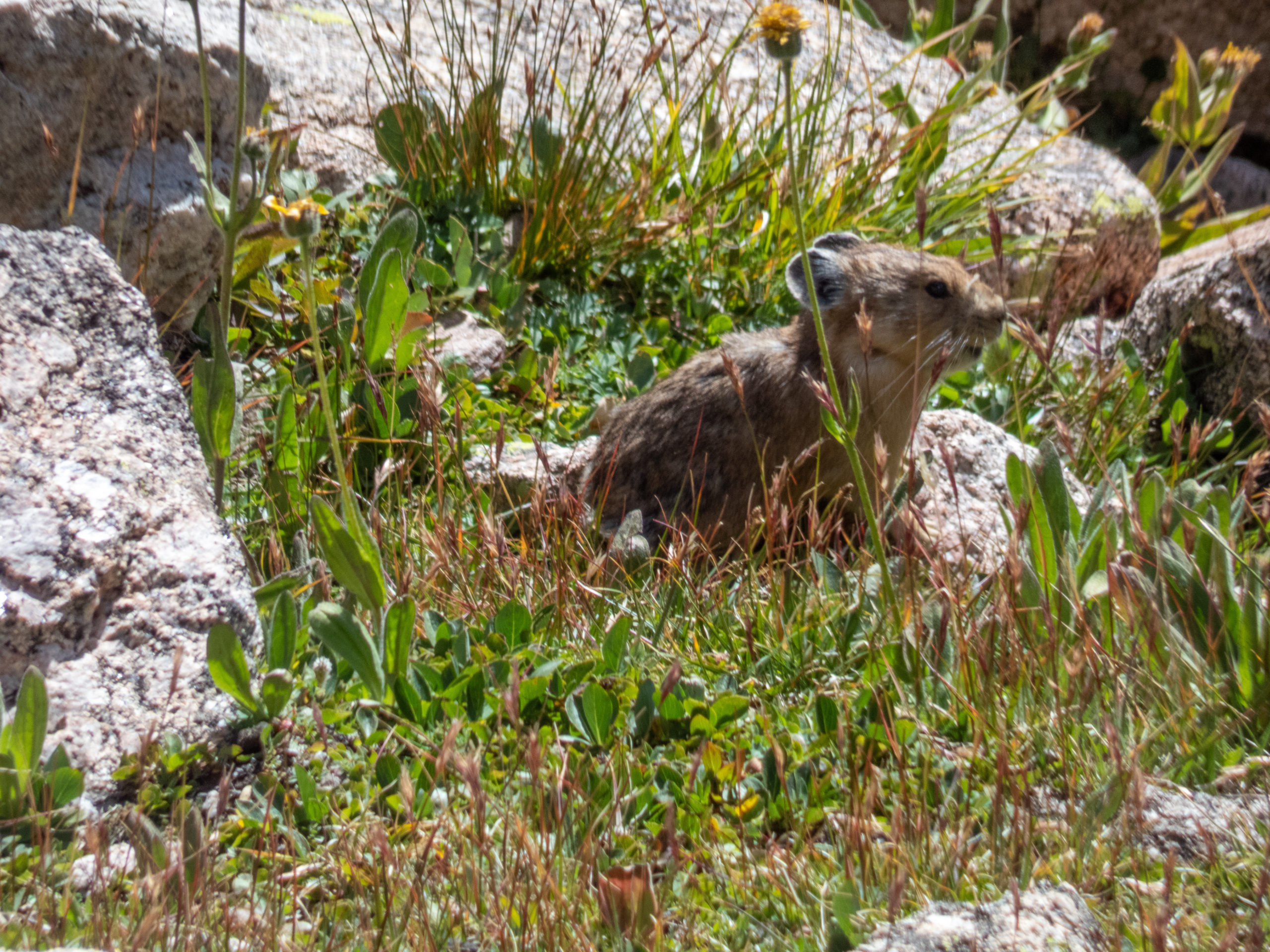
I continued up the trail for about .5 miles and 500′ of elevation gain. Here the area was flat with good views, pika and grassy areas. My energy and mojo felt more like a wandering, fishing day versus a summit. I had a snack, laid in the sun, and contemplated the meaning of life. For those interested, no answers came to me on the meaning of life although it was a nice spot to chill. As another side note, the path up to the summit looks pretty reasonable without any crazy stuff to get there.


New Mission
With my new objective of wandering around and fishing, I headed back to Salmon Lake. I didn’t have any luck since the fish had moved too far out. Next on my list was Lower Lake #1. To help you follow along, I’ve included the handy annotated map below. Off I went, following the same boulder field down and then leaving the trail to go to Lower Lake #1 following one of many social trails in the area.
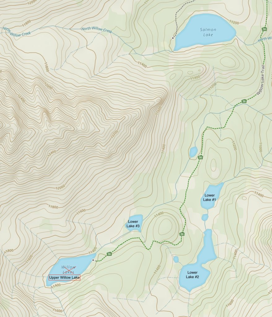
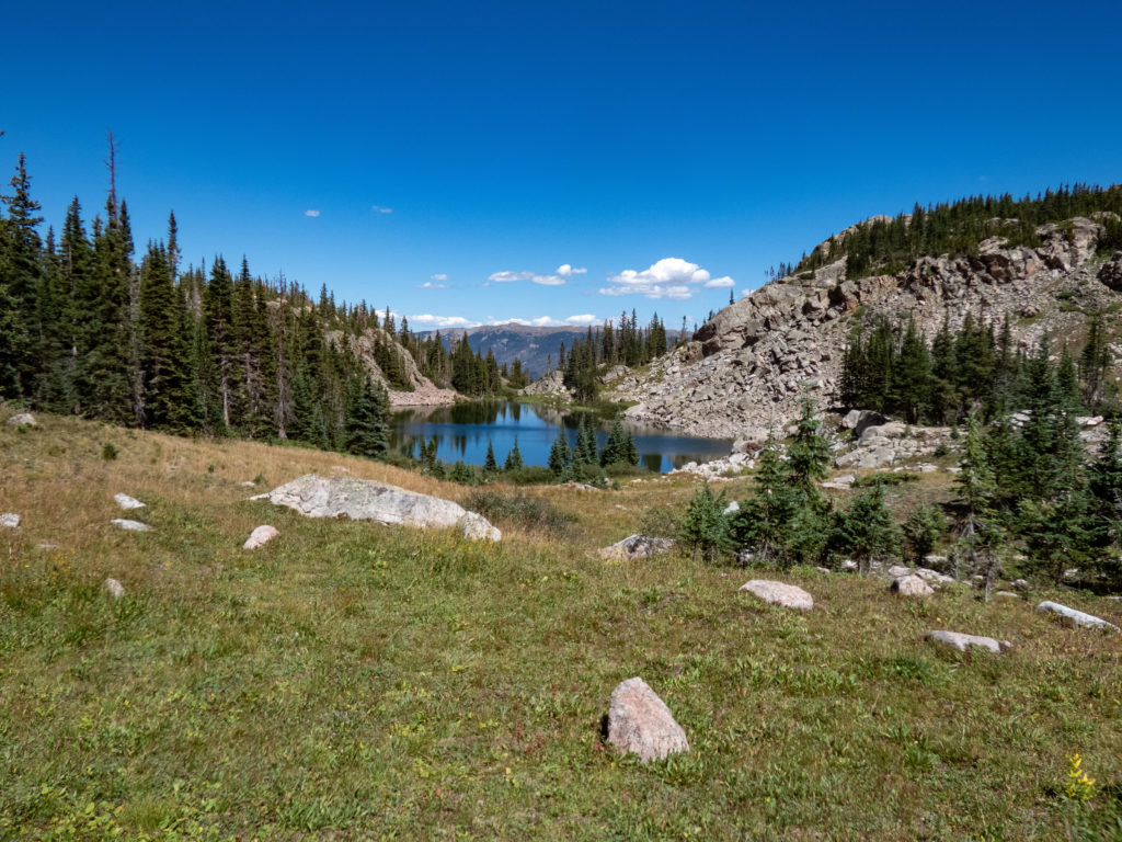
Lower Lake #1
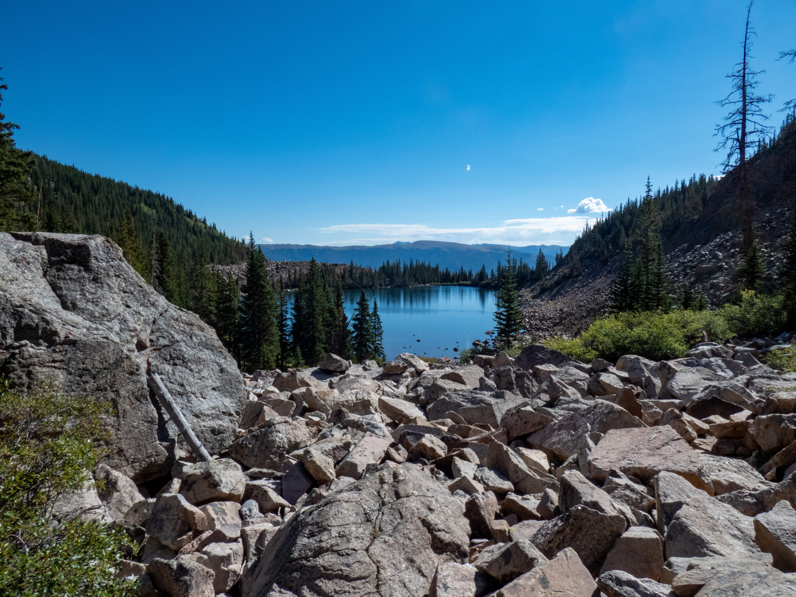
Lower Lake #1 was very clear, and gorgeous. There are several campsites near the lower portion of the lake. The water was so clear I was able to see the bottom in much of the lake, but no fish. It seems like there wasn’t much cover for fish although it is deep. I saw a few rises at the shallower northeast end where the creek leaves the lake. Fishing here was unproductive. I didn’t get a single strike although I know there were at least a few fish here. The area might be better suited to a dry fly with a drop fly on it, which I didn’t try. Oh well, onto the next lake.
Lower Lake #2
I didn’t bother packing up my rod for the short hike up to Lower Lake #2. This lake is a little bigger and there were several fish rising in the lower, more narrow section of the lake. After scrambling up onto some rocks, I was fishing from about 8′-10′ above the water. While there were some trees trying to grab my fly behind me, I was able to avoid them. I caught trout in this area mostly non-stop. They were about the same size as I had caught at Upper Willow Lake. As I caught them, I’d climb down the boulder to the water line, keeping the line taut and reeling in the fish, where I would unhook and release them. This made for a good balance and coordination exercise. It was good fishing for quite a while.
Back to Upper Willow Lake
Somehow I’d managed to spend a lot of the day fishing. It was approaching 2:00 and the day was clearly calling for a catnap. I packed up my rod and headed back to camp wondering what the goats had been up to while I was away. I was quite surprised when I arrived and there were no goats anywhere. That worked for me. Instead of the tent, I sat in my chair and read for a bit. About 3:30 or so, some rain/snow showers and a brisk breeze came by encouraging me to get into the tent and rest my eyes. Later, a bit of thunder briefly woke me from my catnap, but not enough to keep me awake.
The afternoon nap was a good break. During dinner prep, I thought how I’d only seen one other person all day after the busy day before. Just as I noted this in my journal, two hikers showed up to prove me wrong. They were camping at Salmon Lake and had come up to fish for a bit.
After dinner, I fished more until I’d caught all the fish in the lake. Then I walked around for a while and wondered a bit about where my goat friends had gone, although I didn’t miss them in camp. Eventually I called it a night. What a great day it had been!
Upper Willow Lake – Day 3
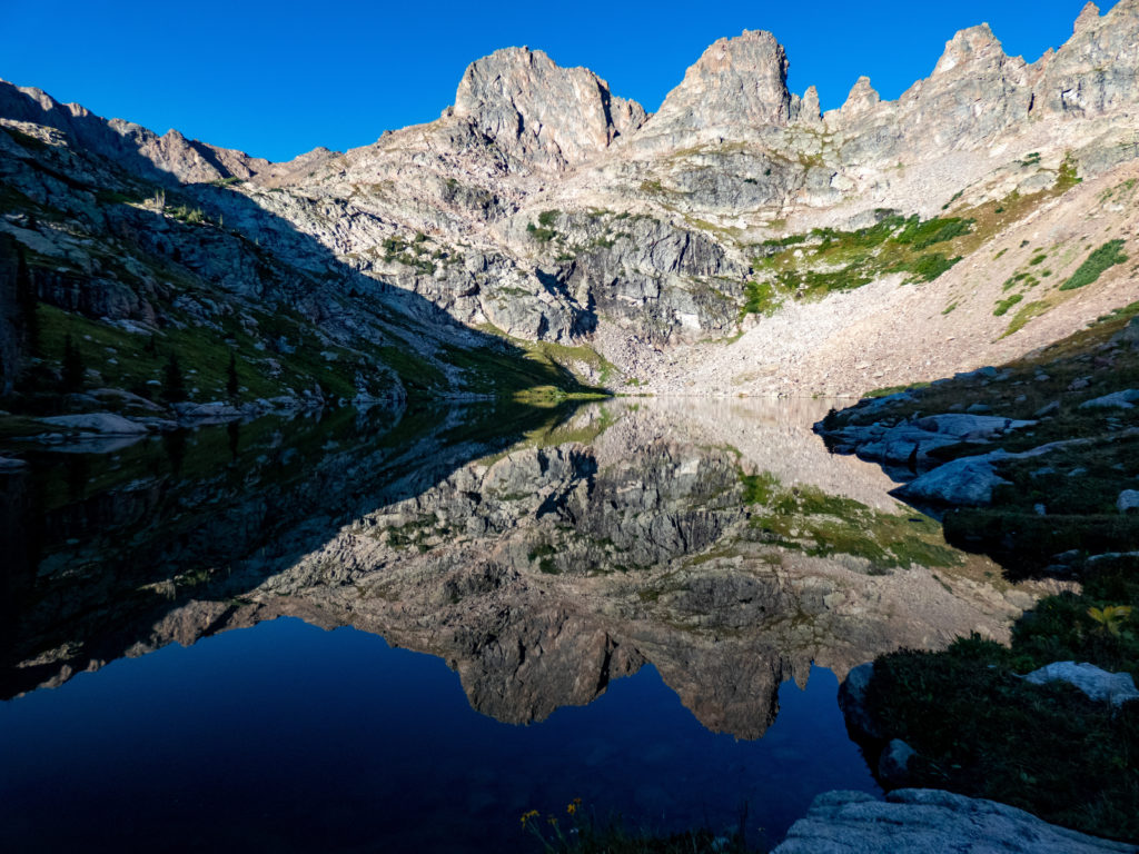
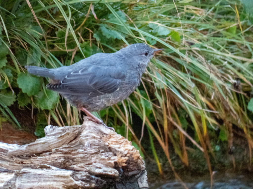
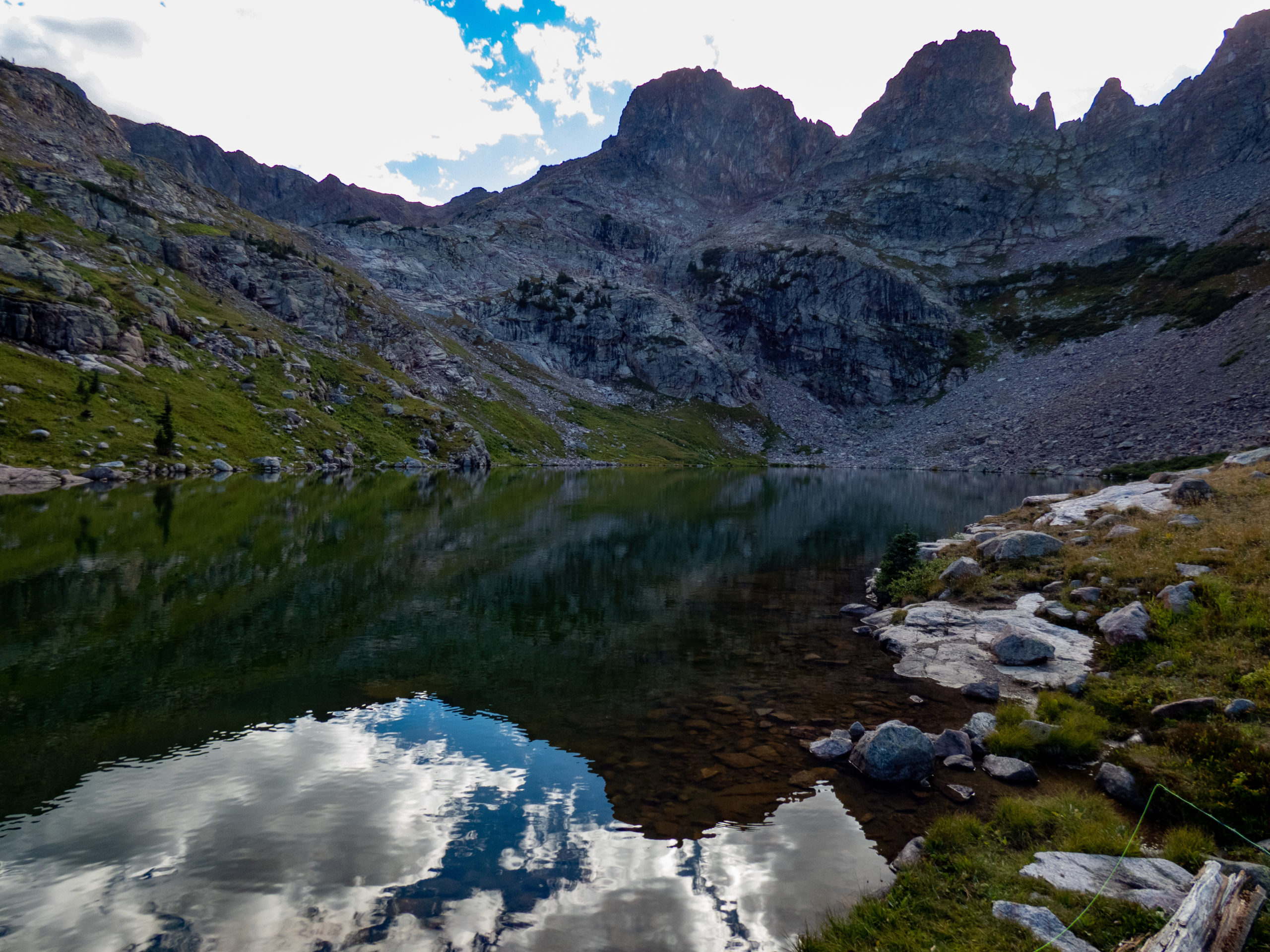
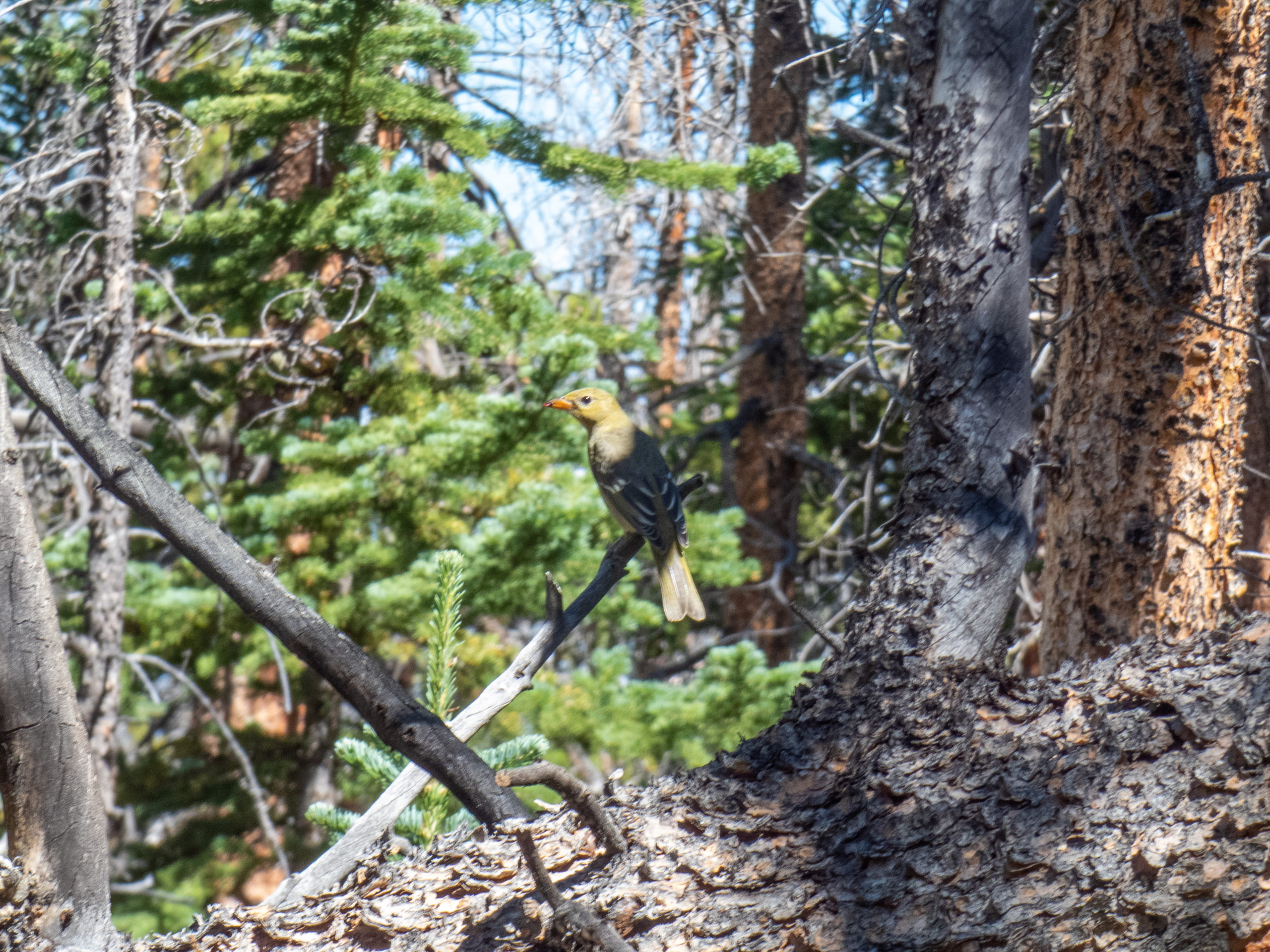
Day 3 started with a short walk around camp. During this walk, I heard some rockfall up in the cirque. Sure enough, my goat friends were headed back. It didn’t take long for one to visit me in camp, probably to see if my pack was handy for a salt fix. He wasn’t too pushy, though, and I was able to pack things up without disruption. The clear morning rewarded me with an amazing reflection shot, so I took it. A bird was fluttering around in the creek, making another nice shot. I took a final glance around and left my beautiful camp.
It was still early and I hadn’t fished Lower Lake #3 yet. It looked like fish were rising, why not fish it too? While setting up my rod, I was surprised to see frost on some plants in the shade. It didn’t seem like it’d been that cold. Maybe this was a pocket of cold air trapped in a low spot? What was I thinking about this stuff for, there were fish to catch! The next hour or so was spent catching many of the same size fish as Upper Willow Lake and Lower Lake #2. When strikes slowed down, I put the rod away and continued on my hike home.
The return hike
The rest of the hike back was uneventful. There were a couple of things to note. One, I wasn’t as fond of the horses after seeing all the poop they left on the trail. It seems like there should be some policy to have the riders deal with the poop. The Forest Service is encouraging people to haul their poop out, why do horses get an exemption?
The other notable event was I met a couple of bow hunters. Apparently the elk season opens 9/2. I didn’t hear or see any elk on my hike. When sharing this, it was clear it wasn’t what they wanted to hear.
It was good to put on my tennis shoes at the trailhead. It’d been a warm hike back and the temp at the trailhead was about 75. I’d thoroughly enjoyed this 3-day trek. Time to head back to the hot city and see my honey!
Upper Willow Lake GPX Track


Max elevation: 11795 ft
Min elevation: 9409 ft
Total climbing: 9616 ft
Total descent: -9649 ft
You caught all the fish in the lake? Impressive.
Yep, all of them. I counted. 🙂
Such great pictures. Almost like I was there without all the work of getting there. Thanks so much for sharing.
Glad you like them!