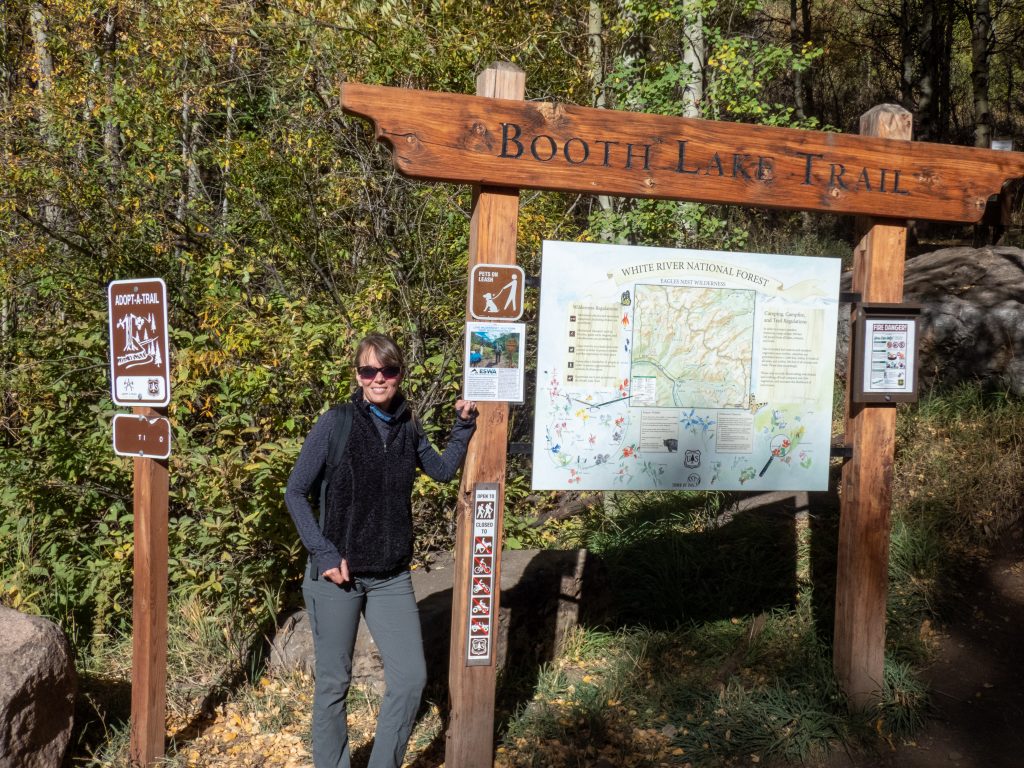
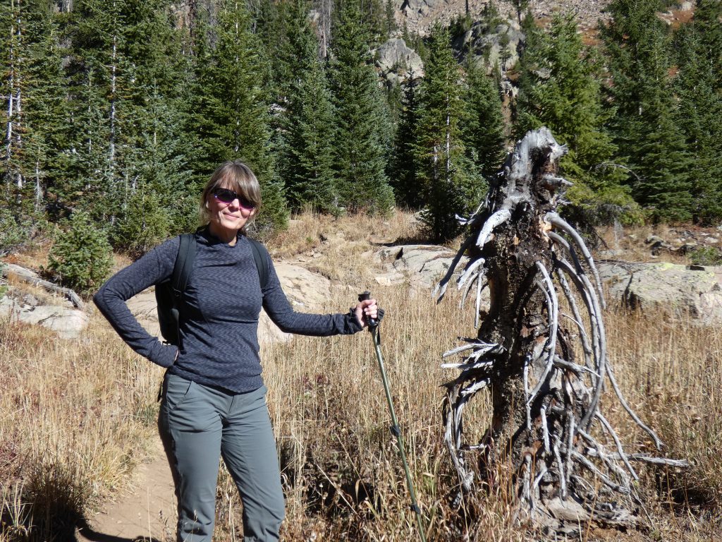
The week in Vail has been good so far. It got better when Tanya came up to stay with me at the condo for a few nights. We wanted to do a big hike Wednesday so we settled on Booth Lake. It didn’t disappoint.
Booth Lake
The trailhead for Booth Lake is north of I-70. It’s easiest to take exit 176 and stay on the frontage road south of the highway going east. At about 3 miles, the frontage road will pass under I-70 and you’ll take the second left onto Booth Falls Road. The trailhead parking is at the end of this road.
Most likely you’ll have to park in the overflow parking at the bottom of the road. The trail services both Booth Falls and Booth Lake. It’s easily one of the most popular Vail Valley hikes due to the shorter Booth Falls hike, so get there early to get a parking spot.
Tanya and I were treated to a full lot and no overflow parking due to some special event. I found a spot at a nearby park with signs clearly saying it wasn’t for trailhead parking. I parked despite Tanya’s suggestion it wasn’t a good idea and I got a parking ticket. So goes life in Vail and next time, listen to Tanya!
Introductory Incline
As with all the hikes this week, the first .25 – .5 miles involve a warm-up incline. This trail didn’t break the rule. The hike up isn’t too bad, however, and you transition quickly into an open meadow with large boulders with less incline. It isn’t long before you can look back to the Vail Valley and see it’s splendor.
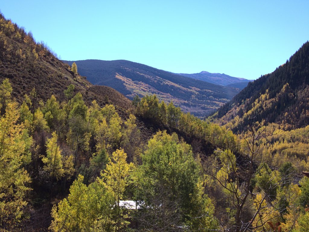
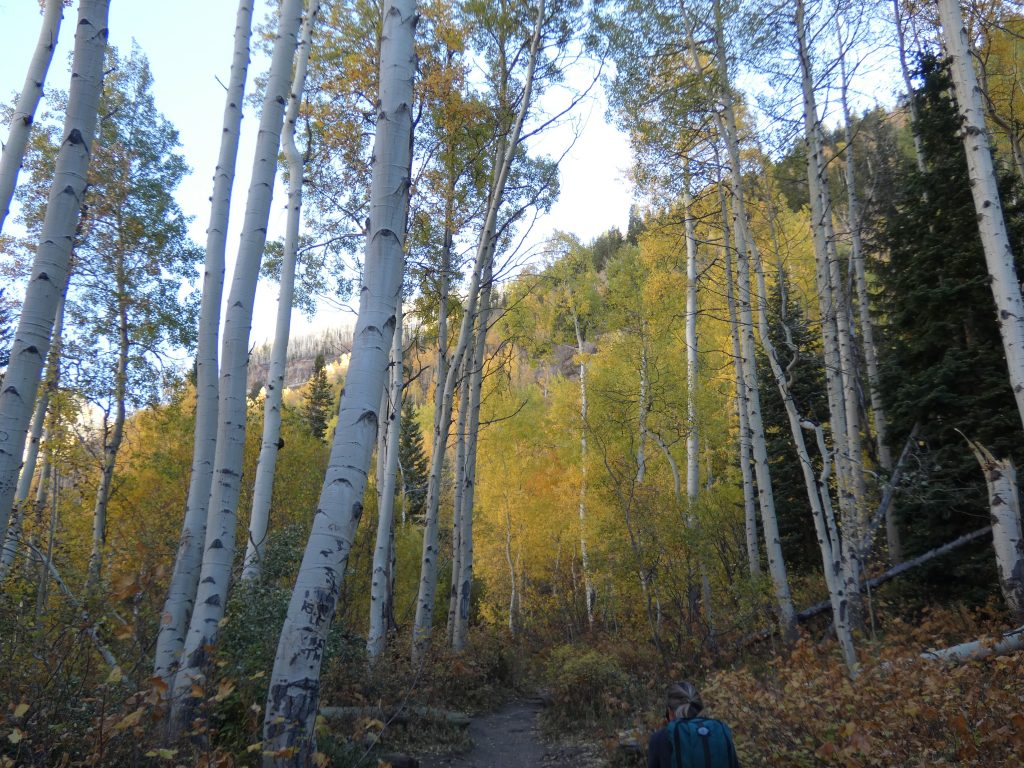
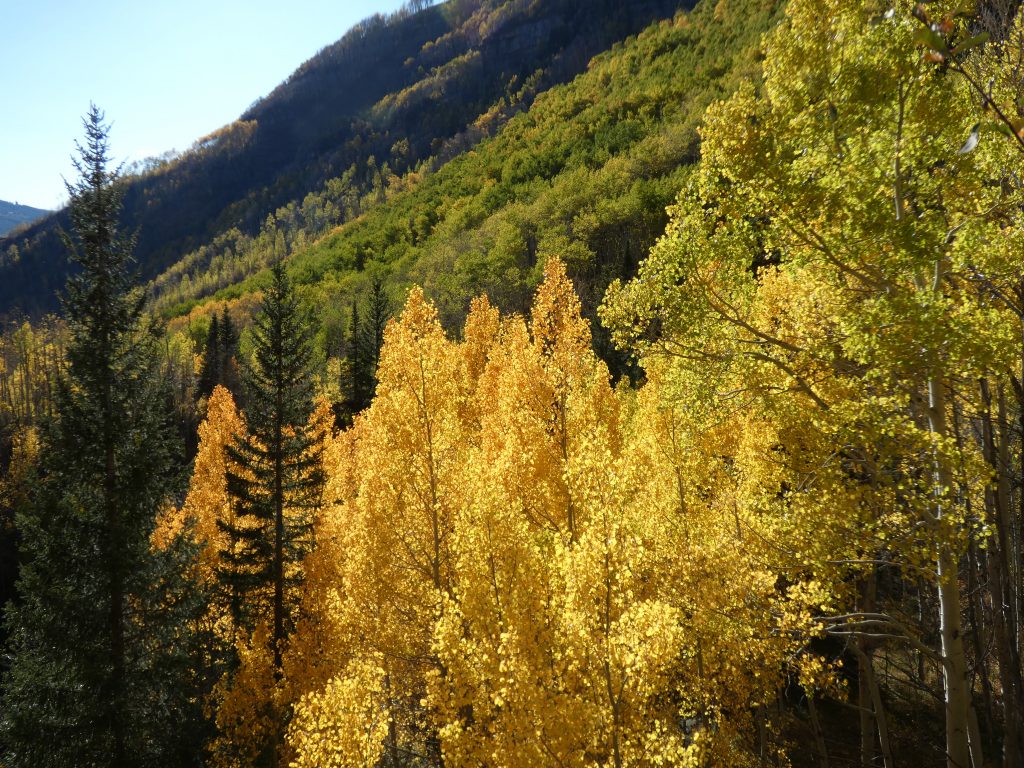
The hiking along the first two miles is pleasant and not too steep after the initial incline. We walked through several healthy Aspen groves, and a few pine groves. Both were peaceful and pretty in their own ways.
Booth Falls
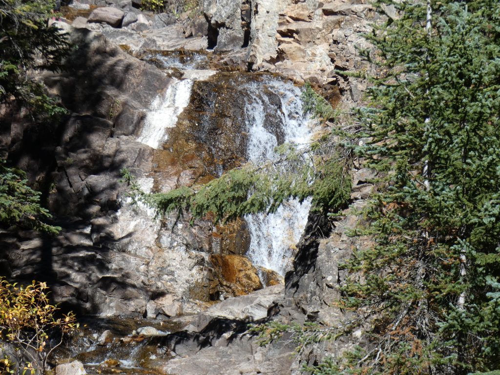
Just shy of two miles you begin the ascent to the falls. The incline increases substantially as you take the heavily used trail up into the pines by the falls.
The best place to see the falls is to walk out onto a huge boulder just below the main falls. There is a well-worn dirt path going up this rock. The area, however, is very steep with precipitous drops, so care is needed. I took this video on some pine stumps that provided great footing upstream from the main falls. The drop at the end of the video is 50′ or so. The time of year and lack of rainfall this year made the water flow quite low.
For comparison, this is a picture from below the drop with higher water flow, July 2, 2013.

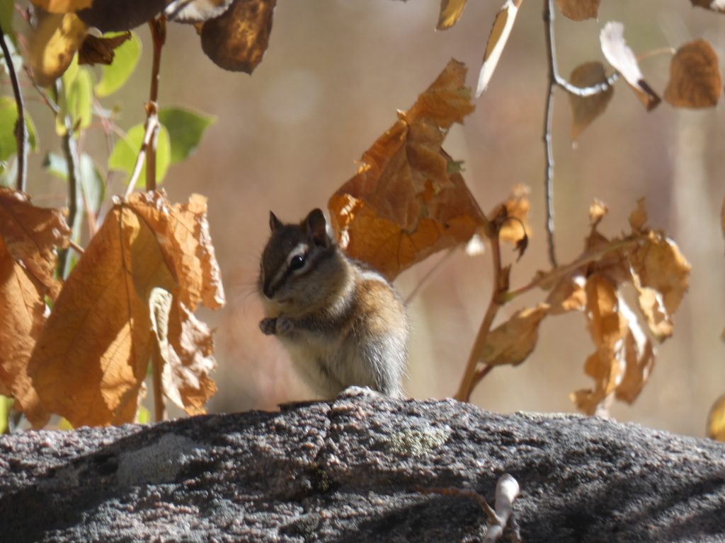
You’ll have shared this section of the trail and falls area with a lot of your closest friends (i.e. it’s busy). Speaking of friends, there are lots of critters at the falls that seem to make their living begging from the visitors. Keep a close eye on your food. Several of these small ground squirrels climbed onto Tanya’s back and legs as she was eating. We had to explain to them that wasn’t ok.
This isn’t the end of the road so don’t get complacent! Enjoy the falls and get going. Keep to the trail on the right near the top of the falls and continue on up. Shortly after the falls you’ll be rewarded with some nice vistas of the valley you just traversed.
Onto Booth Lake!
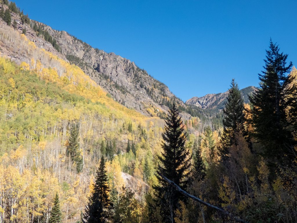
Tanya and I both thought the prettiest part of the trail started after the falls. The climb right after the falls is pretty steep for a short distance. It is one of three steep sections after the falls. After the incline, you are walking through quiet and peaceful pine forests with Booth Creek bubbling next to the trail. When you leave the pine section and enter the following meadow, there are great views all around.
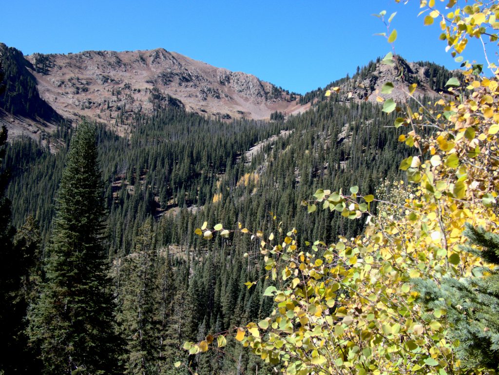
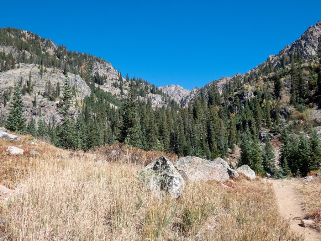
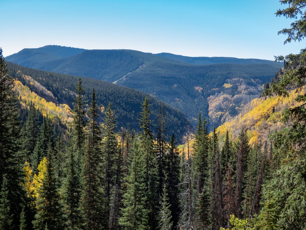
The trail continues in this valley with a mix of open meadow and spruce pines. It’s surrounded by ridgelines with the characteristically steep cliffs of the Gore Range. This section has one steep area as you traverse a ridgeline but most of the hike is a steady incline. The falls are about 1,200′ elevation gain from the trailhead. The lake is 3,200′ so this section keeps you going up steadily to make up the additional 2,000′.
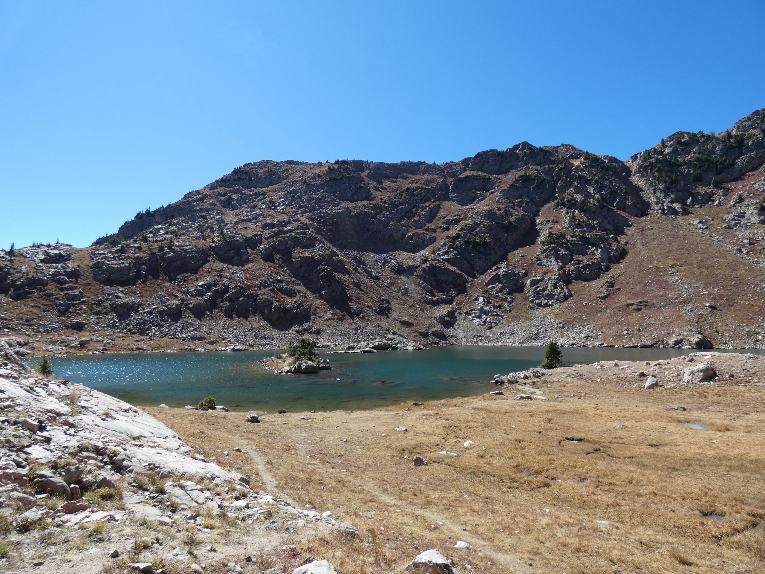
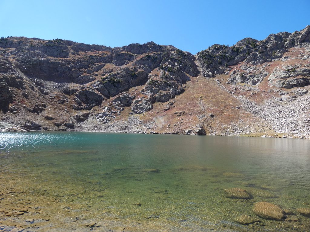
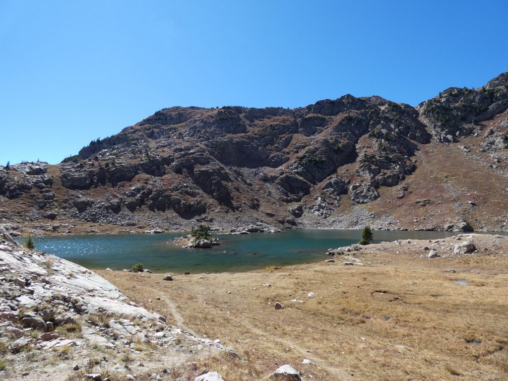
Booth Lake
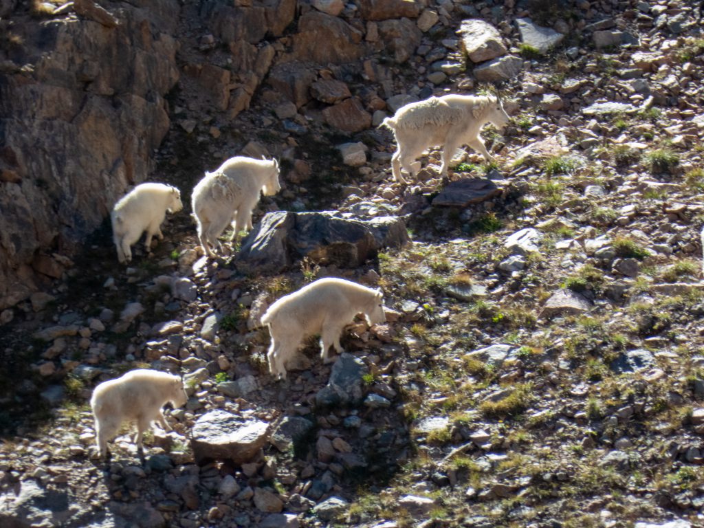
The biggest incline of the hike, or at least it seems the biggest, is just before the lake. The last .5 miles seems longer because it’s pretty steep. The GPS plot below doesn’t do it justice. While we were hiking this section, the gatekeepers of the lake were checking us out. They must have heard us coming up and peaked over the ridge to see what was up.
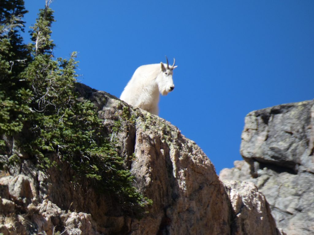
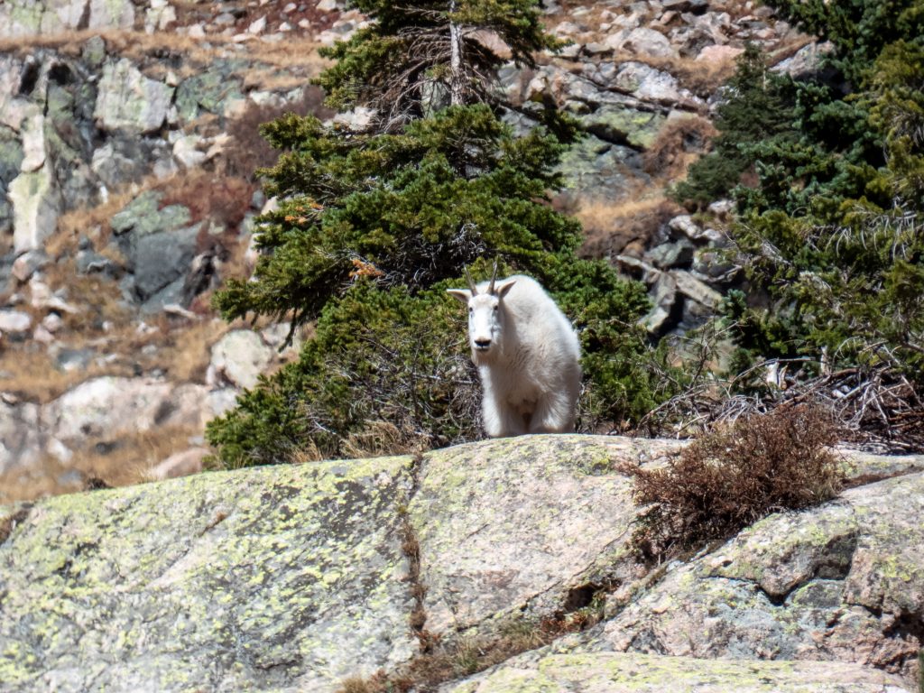
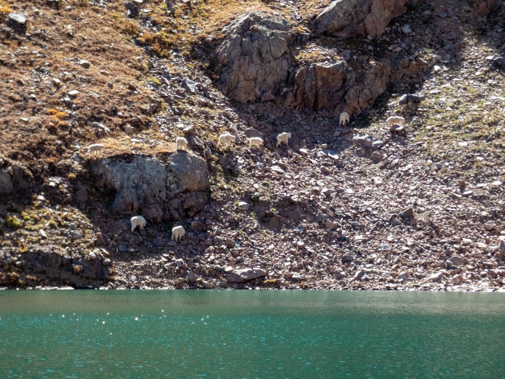
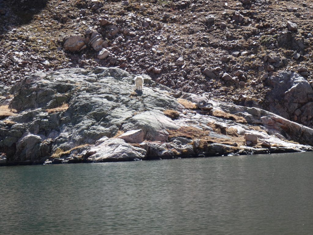
As we came over this ridge, we saw the herd of 9 mountain goats. They weren’t as interested in us after all and meandered off as we continued up to the lake. After one final ridge, we were there and were rewarded with great views. While we snacked and enjoyed the sun, the mountain goats came around the lake on the opposite side. A sunny day, mountain goats, pretty lake, and my honey, what more can you ask for?
Long hike home, with views
After about an hour, we headed down. We took our time and enjoyed the views along the way. There was only one person at the lake when we left and he passed us shortly after we left leaving the entire trail segment between the lake and falls to us, wow.
The falls still had several people hanging around. We met more people as we were going down from the falls than we had the entire day.
When we’d arrived at the bottom, we knew we’d been on a hike. 🙂 The GPS reported a little over 10 miles round trip. It was a long and rewarding day!
Max elevation: 11617 ft
Min elevation: 8294 ft
Total climbing: 7188 ft
Total descent: -7346 ft
im on the side of the sqirrels !